Near Stromness in Orkney, Scotland, United Kingdom — Northwestern Europe (the British Isles)
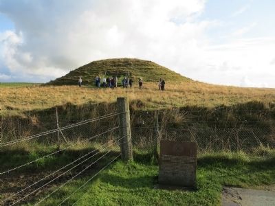
Maes Howe
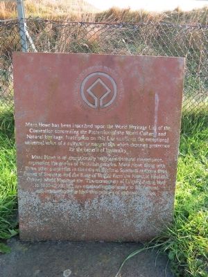
Maes Howe is an exceptionally early architectural masterpiece, expressing the genius of Neolithic peoples. Maes Howe along with three other properties in the care of Historic Scotland at Skara Brae, Stones of Stenness and the Ring of Brogar form the Heart of Neolithic Orkney World Heritage site. The monuments of Orkney dating back to 3000 to 2000 B.C. are outstanding testimony to the cultural achievements of the Neolithic peoples of northern Europe.
Topics. This historical marker is listed in these topic lists: Anthropology & Archaeology • Cemeteries & Burial Sites • Man-Made Features.
Location. 58° 59.769′ N, 3° 11.316′ W. Marker is near Stromness, Scotland, in Orkney. Marker is located near Maeshowe proper. Admission to Maeshowe is through Tormiston Mill which is the visitor centre for Maeshowe, located about 9 miles West of Kirkwall on the A965. Touch for map. Marker is in this post office area: Stromness, Scotland KW16 3HH, United Kingdom. Touch for directions.
Other nearby markers. At least 8 other markers are within 8 kilometers of this marker, measured as the crow flies. Stromness War Memorial (approx. 6.7 kilometers away); The Lieutenant’s House (approx. 7.1 kilometers away); Shipwrecks of Scapa Flow (approx. 7.1 kilometers away); Warehouse (approx. 7.2 kilometers away); Dr John Rae (approx. 7.2 kilometers away); Stromness Lifeboat Station (approx. 7.2 kilometers away); Alexander Graham (approx. 7.3 kilometers away); a different marker also named Alexander Graham (approx. 7.5 kilometers away). Touch for a list and map of all markers in Stromness.
Also see . . . Maeshowe Chambered Cairn. Historic Scotland's page for the Maeshowe Chambered Cairn: Maeshowe is the finest chambered tomb in north-west Europe and more than 5000 years old. It was broken into in the mid-twelfth century by Viking crusaders who carved graffiti runes on the walls of the main chamber. In 1999, Maeshowe was designated part of the Heart of Neolithic Orkney World Heritage Site, along with Skara Brae, Ring of Brodgar and the Stones of Stenness. (Submitted on September 20, 2014.)

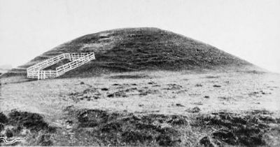
Photographed By C.W. Burrows, 1920
3. The Tumulus of Maeshowe
A mile or two from Stennis stands the celebrated Tumulus of Maeshowe. This is a conical-shaped mound rising to a height of about 35 feet, and surrounded by a moat. The interior is approached by a long, narrow passage, leading into a central stone chamber about 15 feet square, from which a number of crypts or cells branch off at the sides. On the walls are inscribed a number of runes, of which, as one humourist observed, "several professors have given as many translations, apparently all different." There is certainly considerable diversity of opinion as to the age and origin of the mound, but it seems to be generally accepted that it was originally the chambered tomb of some chieftain, dating from early Celtic times.From "Scapa and a Camera", by C.W. Burrows, 1921.
Credits. This page was last revised on January 27, 2022. It was originally submitted on September 4, 2014, by Richard Denney of Austin, Texas. This page has been viewed 582 times since then and 4 times this year. Photos: 1, 2. submitted on September 4, 2014, by Richard Denney of Austin, Texas. 3. submitted on September 20, 2014. • Andrew Ruppenstein was the editor who published this page.

