Fort Belvoir in Fairfax County, Virginia — The American South (Mid-Atlantic)
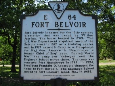
Fort Belvoir
Erected 1999 by Department of Historic Resources. (Marker Number E-64.)
Topics and series. This historical marker is listed in these topic lists: Agriculture • Education • Forts and Castles • Settlements & Settlers • War, World I. In addition, it is included in the Virginia Department of Historic Resources (DHR) series list. A significant historical year for this entry is 1783.
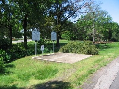
Location. 38° 42.667′ N, 77° 8.63′ W. Marker is in Fort Belvoir, Virginia, in Fairfax County. Marker is at the intersection of Richmond Highway (U.S. 1) and Belvoir Road, on the right when traveling east on Richmond Highway. Located at the Pence Gate for Fort Belvoir. Touch for map. Marker is in this post office area: Fort Belvoir VA 22060, United States of America. Touch for directions.
Other nearby markers. At least 8 other markers are within walking distance of this marker. Belvoir (here, next to this marker); Alexandria, Mt. Vernon, and Accotink Turnpike (a few steps from this marker); Woodlawn Quaker Meetinghouse (approx. ¼ mile away); The Woodlawn Historic District (approx. ¼ mile away); Brown Barracks (approx. half a mile away); Potomac Connections (approx. half a mile away); Necessary (approx. half a mile away); Dairy (approx. 0.6 miles away). Touch for a list and map of all markers in Fort Belvoir.
Also see . . . Establishment of Camp Humpreys. A look at the history of the fort. Links from this page detail the installation's history up to the present day. (Submitted on May 14, 2008, by Craig Swain of Leesburg, Virginia.)
Credits. This page was last revised on May 22, 2022. It was originally submitted on May 14, 2008, by Craig Swain of Leesburg, Virginia. This page has been viewed 1,536 times since then and 26 times this year. Photos: 1, 2. submitted on May 14, 2008, by Craig Swain of Leesburg, Virginia.

