Moorhead in Sunflower County, Mississippi — The American South (East South Central)
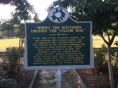
"Where The Southern Crosses The Yellow Dog"
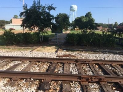
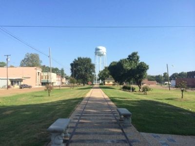
At the start of the twentieth century, the rail crossing once located nearby was an important land transportation point. The junction of the Southern Railroad and the Yazoo Delta Railroad (the “Yellow Dog”) was established in 1897. For decades it was the central Delta's major rail link, making Moorhead one of the region's most active passenger and freight connections. The crossing gained national fame in 1914 with W.C. Handy's seminal blues song “The Yellow Dog Rag.”
Erected 2005 by the Mississippi Department of Archives and History.
Topics and series. This historical marker is listed in these topic lists: Arts, Letters, Music • Entertainment • Railroads & Streetcars. In addition, it is included in the Mississippi State Historical Marker Program series list. A significant historical year for this entry is 1897.
Location. 33° 26.95′ N, 90° 30.414′ W. Marker is in Moorhead, Mississippi, in Sunflower County. Marker is at the intersection of West Delta Avenue and North Southern Avenue, on the left when traveling south on West Delta Avenue. Touch for map. Marker is at or near this postal address: East Delta Avenue, Moorhead MS 38761, United States of America. Touch for directions.
Other nearby markers. At least 8 other markers are within 9 miles of this marker, measured as the crow flies. Johnny Russell (within shouting distance of this marker); "Where the Southern Cross the Dog" (about 400 feet away, measured in a direct line); B.B. King Birthplace (approx. 7.7 miles away); Freedom School Bombing (approx. 8.1 miles away); Club Ebony (approx. 8.1 miles away); Fannie Lou Hamer (approx. 8.3 miles away); Riley B. King (approx. 8.3 miles away); Inverness (approx. 8.3 miles away). Touch for a list and map of all markers in Moorhead.
Also see . . . More about "Where the Southern Cross the Dog". (Submitted on September 16, 2014, by Mark Hilton of Montgomery, Alabama.)
Credits. This page was last revised on June 16, 2016. It was originally submitted on September 16, 2014, by Mark Hilton of Montgomery, Alabama. This page has been viewed 660 times since then and 48 times this year. Last updated on September 17, 2014, by Mark Hilton of Montgomery, Alabama. Photos: 1, 2, 3. submitted on September 16, 2014, by Mark Hilton of Montgomery, Alabama. • Bernard Fisher was the editor who published this page.


