Kenansville in Duplin County, North Carolina — The American South (South Atlantic)
Confederate States Armory
Cutting the Supply Line
— Confederate Lifeline —
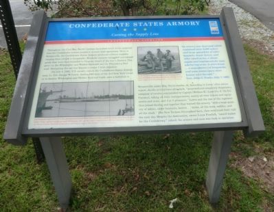
On July 4, 1863, U.S. cavalry struck the Confederate States Armory here. Lt. Col. George W. Lewis, leading 640 men of the 3rd New York Cavalry to destroy Wilmington and Weldon Railroad track, sent a battalion to Kenansville under Maj. Ferris Jacobs, Jr. According to Lewis’ after-action report, Jacobs arrived here after dark, “surprised and completely dispersed a company of cavalry, commanded by Captain (William K.) Lane (Co. F, 7th N.C. Cavalry), taking all their transportation, nearly all their horses and equipments and arms, and 4 or 5 prisoners.” Lewis and the rest of the regiment then joined Jacobs, and together they burned the armory, “with a large quantity of sabers, saber bayonets, knives,…boiler, all the tools, saddles, and all the stock.” The New Yorkers bivouacked here, then continued their raid the next day. Despite the destruction, owner Louis Froelich, “sword maker for the Confederacy,” rebuilt the armory and soon was back in operation.
“An armory was destroyed which contained some 2,500 sabers and large quantities of saber bayonets, bowie knives, and other small-arms, a steam-engine and implements for manufacturing arms. A store-house…a manufactory of knapsacks, and some commissary store-houses were burned.”… — Gen. John G. Foster, July 7, 1863
(captions)
(lower left) The blockade runner Robert E. Lee, photographed about 1864, penetrated the coastal blockade more than 20 times before being captured trying to reach Wilmington, N.C., in Nov. 1863. Converted to USS Fort Donelson, it joined the North Atlantic Blockading Squadron and helped capture Fort Fisher. - Library of Congress
(upper center) North Carolina supplied much of the clothing, shoes, hats, and blankets used by Confederate soldiers such as those captured at Gettysburg, Pa. — Library of Congress
Erected by North Carolina Civil War Trails.
Topics and series. This historical marker is listed in these topic lists: Industry & Commerce • War, US Civil. In addition, it is included in the North Carolina Civil War Trails series list. A significant historical month for this entry is July 1763.
Location. 34° 57.434′ N, 77° 58.228′ W. Marker is in Kenansville, North Carolina, in Duplin County. Marker is at the intersection of Magnolia Extension (State Highway 11) and Mallard Street (State Highway 50), on the left when traveling south on Magnolia Extension. Touch for map. Marker is in this post office area: Kenansville NC 28349, United States of America. Touch for directions.
Other nearby markers. At least 8 other markers are within 8 miles of this marker, measured as the crow flies. A different marker also named Confederate States Armory (a few steps from this marker); Confederate Armory (a few steps from this marker); Grove Church (approx. 0.2 miles away); Liberty Hall (approx. 0.4 miles away); Grove Academy (approx. 0.7 miles away); William Houston (approx. 3.7 miles away); Henry L. Stevens, Jr. (approx. 7˝ miles away); The War Comes to Warsaw (approx. 7˝ miles away). Touch for a list and map of all markers in Kenansville.
Credits. This page was last revised on June 16, 2016. It was originally submitted on September 19, 2014, by Don Morfe of Baltimore, Maryland. This page has been viewed 787 times since then and 22 times this year. Photos: 1, 2. submitted on September 19, 2014, by Don Morfe of Baltimore, Maryland. • Bernard Fisher was the editor who published this page.

