Near Wisconsin Dells in Columbia County, Wisconsin — The American Midwest (Great Lakes)
Kingsley Bend Indian Mounds
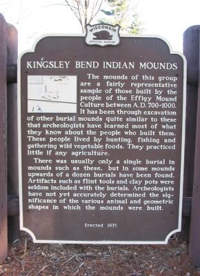
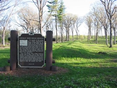
There was usually only a single burial in mounds such as these, but in some mounds upwards of a dozen burials have been found. Artifacts such as flint tools and clay pots were seldom included with the burials. Archeologists have not yet accurately determined the significance of the various animal and geometric shapes in which the mounds were built.
Erected 1971 by the Wisconsin Historical Society. (Marker Number 177.)
Topics and series. This historical marker is listed in these topic lists: Cemeteries & Burial Sites • Native Americans. In addition, it is included in the Wisconsin Historical Society series list.
Location. 43° 36.06′ N, 89° 42.708′ W. Marker is near Wisconsin Dells, Wisconsin, in Columbia County. Marker is on State Highway 16, 0.4 miles east of County Highway O, on the right when traveling east. Marker is 3.1 miles southeast of State Highway 13. Touch for map. Marker is at or near this postal address: W14337 Highway 16, Wisconsin Dells WI 53965, United States of America. Touch for directions.
Other nearby markers. At least 8 other markers are within 3 miles of this marker, measured as the crow flies. First Evangelical Lutheran Church (approx. 0.7 miles away); Logging and Lumbering on the Wisconsin River (approx. 2.6 miles away); Newport Indian Mound (approx. 2.6 miles away); Belle Boyd (approx. 2.7 miles away); Kaminski Park (approx. 2.8 miles away); Honoring Village Trustee Tom Diehl (approx. 2.9 miles away); Lake Delton Catastrophe (approx. 2.9 miles away); Priegel Pier (approx. 2.9 miles away). Touch for a list and map of all markers in Wisconsin Dells.
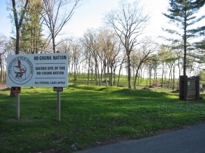
Additional keywords. Sacred site
Ho-Chunk Nation
Credits. This page was last revised on June 16, 2016. It was originally submitted on May 16, 2008, by Keith L of Wisconsin Rapids, Wisconsin. This page has been viewed 2,640 times since then and 52 times this year. Photos: 1, 2, 3. submitted on May 16, 2008, by Keith L of Wisconsin Rapids, Wisconsin. • J. J. Prats was the editor who published this page.


