Clayton in Johnston County, North Carolina — The American South (South Atlantic)
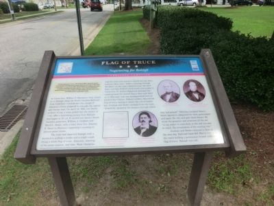
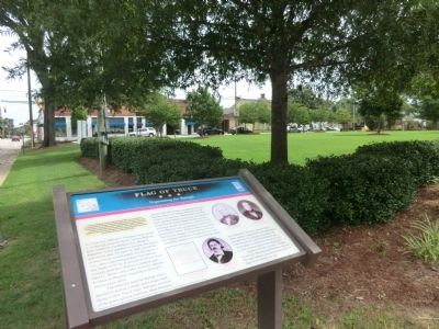
Flag of Truce
Negotiating for Raleigh
— Carolinas Campaign —
(preface) The Carolina Campaign began on February 1, 1865, when Union Gen. William T. Sherman led his army north from Savannah, Georgia, after the March to the Sea. Sherman’s objective was to join Gen. Ulysses S. Grant in Virginia to crush Gen. Robert E. Lee’s Army of the Northern Virginia. Scattered Confederate forces consolidated in North Carolina, the Confederacy’s logistical lifeline, where Sherman defeated Gen. Joseph E. Johnston’s last-ditch attack at Bentonville. After Sherman was reinforced at Goldsboro late in March, Johnston saw the futility of further resistance and surrendered at Bennett Place near Durham on April 26, ending the Civil War in the East.
As Union Gen. William T. Sherman’s army closed in on Raleigh along the North Carolina Railroad from Goldsboro, Confederate Gen. Joseph E. Johnston’s forces prepared to evacuate the capital and retreat west. On April 12, 1865, two blocks in front of you, a train pulled into the station at 7 p. m. after a harrowing journey from Raleigh that began at 10 a.m. It carried two former North Carolina governors, William A. Graham and David L. Swain, with a letter from Gov. Zebulon B. Vance to Sherman requesting a meeting to discuss peace terms.
The train departed Raleigh with a locomotive pulling a tender and single coach flying a white flag of truce. Johnston, learning of the peace mission, had Gen. Wade Hampton stop the train and reverse it outside the city. Soon, however, there were “bullets whizzing through the pines” as the train rolled between skirmish lines, and then Federal cavalrymen surrounded it. Union Gen. H. Judson Kilpatrick detained commissioners for several hours, then sent them on to Sherman, who was headquartered here in present-day Clayton. Federal soldiers cheered the flag of truce, hoping it meant the end of hostilities. Graham and Swain emerged from the train “dreadfully excited at the dangers through which they had passed. “Sherman accepted Vance’s letter, agreed to safeguard the state government and spare the city, and gave them dinner. He wrote the governor and promised all the aid “in my power to contribute to the end you aim to reach, the termination of the existing war.”
Graham and Swain returned to Raleigh the next day. Railroad hand Bob Harris rode atop the coach holding persimmon branch with the flag of truce. Raleigh was safe.
(captions)
Letter from Vance to Sherman Courtesy National Archives and Records Administration
Gov. Zebulon B. Vance Courtesy North Carolina Office of Archives and History
William A. Graham Courtesy Library of Congress
Davvid L. Swain Courtesy North Carolina Collection, University of North Carolina
Major funding for this project was provided by the North Carolina Department of Transportation, through the Transportation Enhancement Program of the Federal Transportation Efficiency Act of the 21st Century
Erected by North Carolina Civil War Trails.
Topics and series. This historical marker is listed in this topic list: War, US Civil. In addition, it is included in the North Carolina Civil War Trails series list. A significant historical date for this entry is April 12, 1865.
Location. 35° 39.202′ N, 78° 27.654′ W. Marker is in Clayton, North Carolina, in Johnston County. Marker is at the intersection of South O'Neil Street and West 2nd Street, on the right when traveling north on South O'Neil Street. Touch for map. Marker is at or near this postal address: 100 S O'Neill St, Clayton NC 27520, United States of America. Touch for directions.
Other nearby markers. At least 8 other markers are within 11 miles of this marker, measured as the crow flies. William E. Dodd (approx. half a mile away); Stone's Mills (approx. 7.7 miles away); Garner Historic District (approx. 8.9 miles away); Tenant House (approx. 10.2 miles away); The Pecan Grove (approx. 10.2 miles away); Carriage House (approx. 10.2 miles away); Farm House (approx. 10.2 miles away); Livestock Barn (approx. 10.2 miles away).
Credits. This page was last revised on March 4, 2023. It was originally submitted on October 10, 2014, by Don Morfe of Baltimore, Maryland. This page has been viewed 838 times since then and 42 times this year. Last updated on March 3, 2023, by Michael Buckner of Durham, North Carolina. Photos: 1, 2. submitted on October 10, 2014, by Don Morfe of Baltimore, Maryland. • Bernard Fisher was the editor who published this page.

