Williamsburg, Virginia — The American South (Mid-Atlantic)
Williamsburg in the Civil War
Gateway to Richmond
— 1862 Peninsula Campaign —
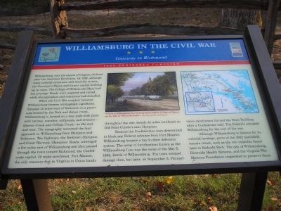
When the Civil War erupted, however, Williamsburg became strategically significant. Situated 12 miles west of Yorktown on a peninsula formed by the York and James rivers, Williamsburg is located on a four-mile-wide plain with ravines, marshes, millponds, and streams – to the east and west. The topography narrowed the land approach to Williamsburg from Hampton and Yorktown. Two highways, the Yorktown-Hampton and Great Warwick (Hampton) Roads, converged a few miles east of Williamsburg and then passed through the town toward Richmond, the Confederate capital, 50 miles northwest. Fort Monroe, the only masonry fort in Virginia in Union hands throughout the war, stands 24 miles southeast on Old Point Comfort near Hampton.
Because the Confederates were determined to block any Federal advance from Fort Monroe, Williamsburg became a key to their defensive system. The array of fortifications known as the Williamsburg Line was the scene of the May 5, 1862, Battle of Williamsburg. The town escaped damage then, but later, on September 5, Pennsylvania cavalrymen burned the Wren Building after a Confederate raid. The Federals occupied Williamsburg for the rest of the war.
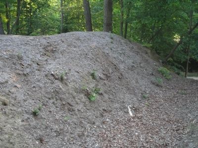
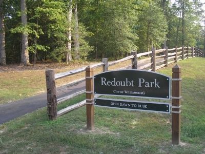
Although Williamsburg is famous for its colonial heritage, parts of the 1862 battlefield remain intact, such as the two redoubts found here in Redoubt Park. The city of Williamsburg, Riverside Health Systems, and the Virginia War Museum Foundation cooperated to preserve them.
Erected by Virginia Civil War Trails.
Topics and series. This historical marker is listed in these topic lists: Notable Places • War, US Civil. In addition, it is included in the Virginia Civil War Trails series list. A significant historical month for this entry is May 1832.
Location. 37° 15.287′ N, 76° 41.1′ W. Marker is in Williamsburg, Virginia. Marker is on Quarterpath Road, on the left when traveling south. Marker is located in Redoubt Park on Quarterpath Road in Williamsburg. Touch for map. Marker is in this post office area: Williamsburg VA 23185, United States of America. Touch for directions.
Other nearby markers. At least 8 other markers are within walking distance of this marker. Defending the Peninsula (within shouting distance of this marker); Redoubt 1 (about 300 feet away, measured in a direct line); Quarterpath Road (about 400 feet away); Battle of Williamsburg (about 400 feet away); a different marker also named Battle of Williamsburg (approx. ¼ mile away); Redoubt 2 (approx. ¼ mile away); History of Fort Magruder (approx. 0.6 miles away); a different marker also named Battle of Williamsburg (approx. ¾ mile away). Touch for a list and map of all markers in Williamsburg.
More about this marker. The top of the marker contains a picture of “A View in Williamsburg, Va.,” showing wagons on Duke of Gloucester St., by William McIlvaine – Courtesy Library of Congress. Next to this is a map showing the locations of other Civil War Trails markers.
Related markers. Click here for a list of markers that are related to this marker. Markers on the walking trail of Williamsburg’s Redoubt Park.
Also see . . .
1. Battle of Williamsburg, 5 May 1862. Williamsburg was the first large battlefield encounter between Union and Confederate forces during the Peninsula Campaign of 1862. (Submitted on August 19, 2008, by Bill Coughlin of Woodland Park, New Jersey.)
2. The Peninsula Campaign of 1862. (Submitted on August 19, 2008, by Bill Coughlin of Woodland Park, New Jersey.)
Credits. This page was last revised on April 26, 2021. It was originally submitted on August 19, 2008, by Bill Coughlin of Woodland Park, New Jersey. This page has been viewed 2,989 times since then and 49 times this year. Last updated on April 24, 2021, by Bradley Owen of Morgantown, West Virginia. Photos: 1, 2, 3, 4. submitted on August 19, 2008, by Bill Coughlin of Woodland Park, New Jersey. • J. Makali Bruton was the editor who published this page.


