Near Model in Las Animas County, Colorado — The American Mountains (Southwest)
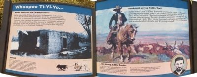
Whoopee Ti-Yi-Yo...
In the fall of 1846, William Bent, supervising partner of Bent's Fort, selected a site on the Purgatoire River, about five miles downstream from here, to create one of Colorado's first farming-ranching ventures.
He hired John Hatcher, an experienced mountain man, and about fifteen laborers from Taos, New Mexico, to construct some ranch buildings on the site, to plant crops, and to dig the first irrigation ditch in soon-to-be Colorado Territory.
Unrest
Corn and other crops were planted and the ranch was stocked with cattle and other livestock, but the local Ute Indians took offense at this intrusion into their territory. One dark night, they stole all the horses and mules and killed most of the cattle. John Hatcher hitched two of the remaining cattle to a cart and headed for sanctuary at Bent's Fort, thereby ending Bent's short-lived ranching venture.
Goodnight-Loving Cattle Trail
At the end of the Civil War, Texas was overrun by cattle. Colorado's growing population of miners and settlers clamored for meat. In 1865, Texas cattlemen Charles Goodnight and Oliver Loving met the demand, blazing routes through desolate, hazardous country with their herds of cattle. They drove thousands of longhorns to markets and stocked early Colorado and Wyoming ranches.
...Git Along, Little Dogies
In 1868, Goodnight trailed a large herd of cattle northward over Trinchera Pass, just a few miles south of here. Pioneering this route, he avoided paying the ten cents per cow that Richens Lacy “Uncle Dick” Wootton charged for use of his Raton Pass toll road. During the next three years, Goodnight delivered 30,000 cattle to this region. His enterprise helped to found the cattle industry in southern Colorado.
Topics. This historical marker is listed in this topic list: Agriculture. A significant historical year for this entry is 1846.
Location. 37° 23.19′ N, 104° 14.303′ W. Marker is near Model, Colorado, in Las Animas County. Marker is on U.S. 350 at milepost 15, on the right when traveling north. Touch for map. Marker is in this post office area: Model CO 81059, United States of America. Touch for directions.
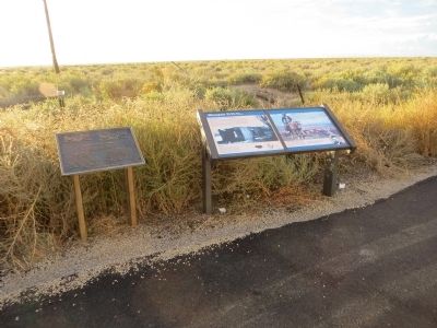
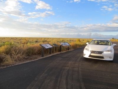
Other nearby markers. At least 2 other markers are within walking distance of this marker. In Memory of the Crewmen (here, next to this marker); The Santa Fe Trail (here, next to this marker).
Credits. This page was last revised on June 16, 2016. It was originally submitted on October 11, 2014, by Bill Kirchner of Tucson, Arizona. This page has been viewed 691 times since then and 12 times this year. Photos: 1, 2, 3. submitted on October 11, 2014, by Bill Kirchner of Tucson, Arizona. • Andrew Ruppenstein was the editor who published this page.


