Near Durant in Bryan County, Oklahoma — The American South (West South Central)
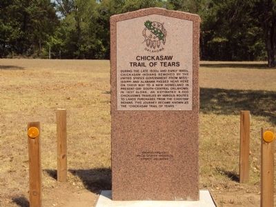
Chickasaw Trail of Tears
During the late 1830s and early 1840s, Chickasaw Indians removed by the United States Government from Alabama and Mississippi passed near here on their way to a new home in present-day south-central Oklahoma. In 1837 alone, an estimated 6,000 Chickasaws traveled by various routes to lands purchased from the Choctaw Indians. This journey became known as the "Chickasaw Trail of Tears."
Erected by Oklahoma Historical Society.
Topics and series. This historical marker is listed in this topic list: Native Americans. In addition, it is included in the Oklahoma Historical Society series list. A significant historical year for this entry is 1837.
Location. 34° 6.267′ N, 96° 32.7′ W. Marker is near Durant, Oklahoma, in Bryan County. Marker can be reached from State Highway 199, 3˝ miles west of State Highway 78, on the right when traveling west. Marker is located on the grounds of Fort Washita State Historic Site. Touch for map. Marker is at or near this postal address: 3348 Hwy 199, Durant OK 74701, United States of America. Touch for directions.
Other nearby markers. At least 8 other markers are within 12 miles of this marker, measured as the crow flies. Colbert Family (about 500 feet away, measured in a direct line); General Douglas Hancock Cooper (about 600 feet away); Fort Washita (approx. 0.2 miles away); Chickasaw White House (approx. 7.1 miles away); Fort McCulloch (approx. 8 miles away); Nail's Crossing (approx. 9 miles away); Howitzer M 110-8 8" Self Propelled (approx. 12 miles away); Pennington Creek (approx. 12 miles away). Touch for a list and map of all markers in Durant.
Also see . . . Fort Washita. Oklahoma History Center (Submitted on October 13, 2014.)
Credits. This page was last revised on June 16, 2016. It was originally submitted on October 13, 2014, by Michael Manning of Woodlawn, Tennessee. This page has been viewed 1,138 times since then and 66 times this year. Photo 1. submitted on October 13, 2014, by Michael Manning of Woodlawn, Tennessee. • Bernard Fisher was the editor who published this page.
Editor’s want-list for this marker. A photo of the marker and the surrounding area in context. • Can you help?
