Williamsburg, Virginia — The American South (Mid-Atlantic)
Battle of Williamsburg
Emory’s Failed Advance
— 1862 Peninsula Campaign —
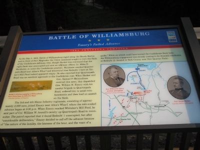
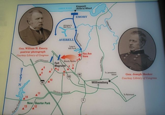
The 3rd and 4th Maine Infantry regiments, consisting of approximately 2,000 men, joined Emory near Allen’s Wharf, where the rain-soaked advance began at 3:30 p.m. When Emory reached Whitaker’s Mill Pond, he sent part of Col. William W. Averell’s cavalry up Quarterpath Road to reconnoiter. The patrol reported that it found Redoubt 1 unoccupied, but after “considerable deliberation,” Emory decided to call off the advance because of “the nature of the locality, the lateness of the hour, and the want of a guide.” While an attack could have turned the Confederate flank here, the Williamsburg engagement was already coming to its dramatic conclusion at Redoubt 11 (located in York County near New Quarter Park).
Erected by Virginia Civil War Trails.
Topics and series. This historical marker is listed in these topic lists: Notable Events • Notable Places • War, US Civil. In addition, it is included in the Virginia Civil War Trails series list. A significant historical month for this entry is May 1827.
Location. 37° 15.232′ N, 76° 41.154′ W. Marker is in Williamsburg, Virginia. Marker can be reached from Quarterpath Road, on the left when traveling south. Marker is located in Redoubt Park on Quarterpath Road in Williamsburg. Touch for map. Marker is in this post office area: Williamsburg VA 23185, United States of America. Touch for directions.
Other nearby markers. At least 8 other markers are within walking distance of this marker. Quarterpath Road (a few steps from this marker); Redoubt 1 (within shouting distance of this marker); Defending the Peninsula (about 400 feet away, measured in a direct line); Williamsburg in the Civil War (about 400 feet away); a different marker also named Battle of Williamsburg (approx. 0.3 miles away); Redoubt 2 (approx. 0.3 miles away); History of Fort Magruder (approx. 0.7 miles away); a different marker also named Battle of Williamsburg (approx. 0.8 miles away). Touch for a list and map of all markers in Williamsburg.
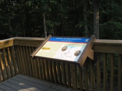
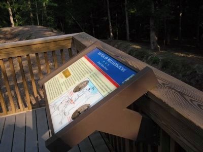
More about this marker. The marker contains an Alfred R. Waud sketch of “Hooker’s division engaging at Williamsburg from Union lines." There are also photographs of Gen. William H. Emory and Gen. Joseph Hooker. All pictures are courtesy of Library of Congress. The marker also contains a battle map showing troop movements and the location of Confederate fortifications.
Related markers. Click here for a list of markers that are related to this marker. Markers on the walking trail of Williamsburg’s Redoubt Park.
Also see . . .
1. Battle of Williamsburg, 5 May 1862. Williamsburg was the first large battlefield encounter between Union and Confederate forces during the Peninsula Campaign of 1862. (Submitted on August 20, 2008, by Bill Coughlin of Woodland Park, New Jersey.)
2. The Peninsula Campaign of 1862. (Submitted on August 20, 2008, by Bill Coughlin of Woodland Park, New Jersey.)
3. Tidewater Virginia, The 1862 Peninsula Campaign. Civil War Traveler. (Submitted on August 20, 2008, by Bill Coughlin of Woodland Park, New Jersey.)
Credits. This page was last revised on June 16, 2016. It was originally submitted on August 20, 2008, by Bill Coughlin of Woodland Park, New Jersey. This page has been viewed 6,084 times since then and 40 times this year. Last updated on October 15, 2014, by Peter Jones of Williamsburg, VA - Virginia. Photos: 1, 2, 3, 4, 5, 6. submitted on August 20, 2008, by Bill Coughlin of Woodland Park, New Jersey. • Bill Pfingsten was the editor who published this page.
