Near Spicer in Kandiyohi County, Minnesota — The American Midwest (Upper Plains)
Victory Dance
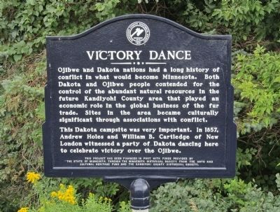
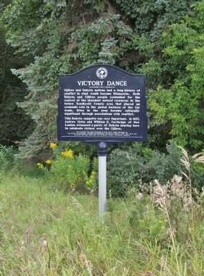
This Dakota campsite was very important. In 1857, Andrew Holes and William B. Cartledge of New London witnessed a party of Dakota dancing here to celebrate victory over the Ojibwe.
the State of Minnesota through the Minnesota Historical Society from the Arts and
Cultural Heritage Fund and the Kandiyohi County Historical Society.
Erected by the State of Minnesota through the Minnesota Historical Society and the Kandiyohi County Historical Society.
Topics and series. This historical marker is listed in these topic lists: Native Americans • Wars, US Indian. In addition, it is included in the Minnesota Historical Society series list. A significant historical year for this entry is 1857.
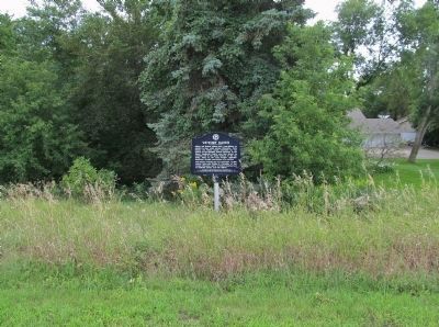
Location. 45° 14.083′ N, 94° 59.553′ W. Marker is near Spicer, Minnesota, in Kandiyohi County. Marker can be reached from the intersection of 113th Avenue Northeast (County Highway 10) and County Highway 9, on the left when traveling west. Marker is along the highway frontage road southeast of the intersection. Touch for map. Marker is at or near this postal address: 3725 113th Avenue Northeast, Spicer MN 56288, United States of America. Touch for directions.
Other nearby markers. At least 8 other markers are within 4 miles of this marker, measured as the crow flies. Olof Olson Haugen (approx. ¾ mile away); Spicer (approx. 2.6 miles away); Veterans Memorial (approx. 2.6 miles away); Little Crow's Camp (approx. 2.7 miles away); Green Lake Village and Mill (approx. 3.4 miles away); Fullerville (approx. 3.8 miles away); Kandiyohi County's First Church (approx. 3.9 miles away); The Erickson Cabin (approx. 3.9 miles away). Touch for a list and map of all markers in Spicer.
More about this marker. The marker has the Historic Site seal of the Kandiyohi County Historical Society · 1895.
Also see . . .
1. Ojibwe. Wikipedia entry. (Submitted on October 17, 2014.)
2. Sioux. Wikipedia entry. (Submitted on October 17, 2014.)
3. Battle of the Brule. Wikipedia entry. "...the Battle of the Brule was an example of the type of ongoing conflict the two nations were engaged in during the 18th and early 19th centuries. This continued warfare between the Dakota and Ojibwe figured heavily in U.S. government policy in the Wisconsin Territory. The Treaty of Prairie du Chien (1825) had been arranged with the pretext of creating peace between the two nations, and in later treaties and negotiations the government repeatedly demanded the two groups end hostilities so white settlers would see Wisconsin as a peaceful region." (Submitted on October 17, 2014.)
4. The Ojibwe Native Americans. "The Ojibwe had little conflict with the United States during their reign, even after Fort Snelling was built in Minnesota to try to section off the Dakota from the Ojibwe. This may have been because they knew they had little chance of victory over the numerous, technologically advanced settlers. Although they presented little direct problem to the whites, they still went on attacking the Dakota as the hostilities between the two tribes continued on." (Submitted on October 17, 2014.)
5. Ojibwe and Sioux Beginnings. The Sioux Massacre at Fort St. Charles, 1736. "After the massacre... French traders at La Pointe tried to halt the fighting, but this had been coming for years, and neither the Dakota nor the Ojibwe would listen. The war was on, and this was just the beginning." (Submitted on October 17, 2014.)
Additional keywords. Chippewa;
Sioux
Credits. This page was last revised on June 7, 2021. It was originally submitted on October 17, 2014, by Keith L of Wisconsin Rapids, Wisconsin. This page has been viewed 560 times since then and 17 times this year. Photos: 1, 2, 3. submitted on October 17, 2014, by Keith L of Wisconsin Rapids, Wisconsin.


