Dartmouth in Halifax Region, Nova Scotia — The Atlantic Provinces (North America)
A Changing Lake-scape

Photographed By Barry Swackhamer, June 15, 2014
1. A Changing Lake-scape Marker
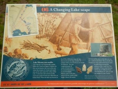
Captions: Right: An example of 1 of 19 stone beacons constructed as aids to navigating the canal and waterways.; Above: These stone spear and arrow points are typical of the Mi’kmaq artifacts found in this area during the excavations by Dr. Stephen Davis and his students in the 1970s.
Lake Micmac was considerably smaller before the Canal was begun. Evidence for this can be found in the cove to the west where the remains of a forest and marsh area can be seen under the surface of the Lake. To the east is the entrance to the canal and a point of land once referred to as Indian Point. When the lake was lowered in the 1970s a Mi’kmaq camp site was discovered and the large number of artifacts which were found are now in the NS Museum. This lake is approximately 20 meters (65 feet) above the level of the Harbour. An Incline Marine Railway and a lock were used to lift the vessels to this height. About 100 meters (325 feet) off the shore of the lake you can see a small round island. This is the actually the remains of a man-made stone beacon used to guide boats toward the entrance of the Canal Cut. Two examples of these stone beacons can be seen in Sullivan’s Pond near Hawthorne St. and you will see another in Lake Charles.
Erected by Shubenacadie Canal Commission. (Marker Number 06.)
Topics. This historical marker is listed in this topic list: Waterways & Vessels.
Location. 44° 41.869′ N, 63° 33.14′ W. Marker is in Dartmouth, Nova Scotia, in Halifax Region. Marker can be reached from Lock Road, on the left when traveling north. Touch for map. Marker is at or near this postal address: 54 Lock Road, Dartmouth NS B2X, Canada. Touch for directions.
Other nearby markers. At least 8 other markers are within walking distance of this marker. Unique Construction (about 150 meters away, measured in a direct line); Barges, Steamboats and Scows (about 180 meters away); Historic Shubenacadie Canal System (about 180 meters away); Lightning Strikes at Canal Camp (about 210 meters away); A Testament to Hard Work (about 210 meters away); A Village of the Most Primitive Description (approx. 0.3 kilometers away); Of Bough and Bark (approx. 0.4 kilometers away); Before the Canal (approx. 0.4 kilometers away). Touch for a list and map of all markers in Dartmouth.
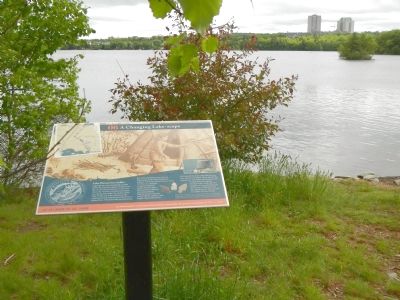
More about this marker. This marker is on the shore of Lake Micmac to the west of where the canal enters the lake.
Credits. This page was last revised on June 16, 2016. It was originally submitted on October 18, 2014, by Barry Swackhamer of Brentwood, California. This page has been viewed 515 times since then and 20 times this year. Photos: 1, 2. submitted on October 18, 2014, by Barry Swackhamer of Brentwood, California. • Andrew Ruppenstein was the editor who published this page.
