Plymouth in Windsor County, Vermont — The American Northeast (New England)
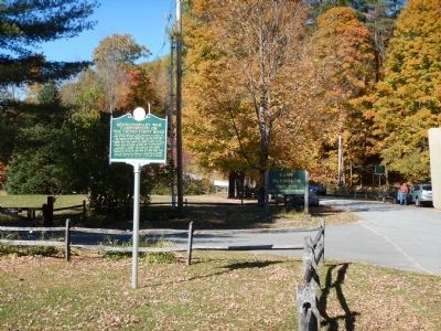
Revolutionary War Campground on the Crown Point Road
Inscription.
This lakeside meadow was a 1777 campground for Rindge NH troops en route to Mount Independence and Fort Ticonderoga to fight Burgoyne's invading British army. The 1776 Crown Point Road linking Fort No. 4 on the Connecticut River to Lake Champlain forts closely followed the present highway. The earlier 1759-60 Crown Point Road, ordered built by British General Amherst during the French and Indian War, passed further to the south. It followed Indian trails and later brought homesteaders to Vermont. The Black River ponds were at a portage point between the Black River and Otter Creek. Other campsites may be found nearby. The Boy Scouts of America owned this property and operated a summer camp here from 1927 – 1984 when the land was sold to the State of Vermont.
Erected 2007 by Vermont Division for Historic Preservation.
Topics. This historical marker is listed in these topic lists: War, French and Indian • War, US Revolutionary • Waterways & Vessels. A significant historical year for this entry is 1777.
Location. 43° 28.594′ N, 72° 41.71′ W. Marker is in Plymouth, Vermont, in Windsor County. Marker is on Scout Camp Road, half a mile north of Kingdom Road, on the right when traveling south. Marker is located near the entrance to Camp Plymouth State Park. Touch for map. Marker is at or near this postal address: 2008 Scout Camp Road, Ludlow VT 05149, United States of America. Touch for directions.
Other nearby markers. At least 8 other markers are within 6 miles of this marker, measured as the crow flies. Vermont Gold Rush (within shouting distance of this marker); Calvin Coolidge Homestead (approx. 4.3 miles away); Calvin Coolidge (approx. 4.3 miles away); Plymouth WW1 Memorial (approx. 4.3 miles away); Capt. John Coolidge Flagpole (approx. 4.4 miles away); Achsa W. Sprague (1827-1862) (approx. 4.4 miles away); Mount Holly Railroad History (approx. 4.9 miles away); Abby Maria Hemenway (approx. 5˝ miles away). Touch for a list and map of all markers in Plymouth.
Credits. This page was last revised on June 16, 2016. It was originally submitted on October 20, 2014, by Kevin Craft of Bedford, Quebec. This page has been viewed 671 times since then and 33 times this year. Photos: 1, 2. submitted on October 20, 2014, by Kevin Craft of Bedford, Quebec. • Bill Pfingsten was the editor who published this page.

