Near Leesburg in Loudoun County, Virginia — The American South (Mid-Atlantic)
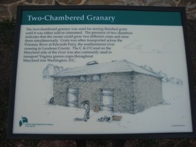
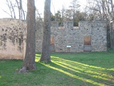
Two-Chambered Granary
Erected 2008 by Northern Virginia Regional Park Authority.
Topics and series. This historical marker is listed in this topic list: Agriculture. In addition, it is included in the NOVA Parks series list.
Location. 39° 6.766′ N, 77° 30.628′ W. Marker is near Leesburg, Virginia, in Loudoun County. Marker is at the intersection of Edwards Ferry Road (County Route 773) and Red Rock Way, on the right when traveling west on Edwards Ferry Road. Located at the parking lot for the Red Rock Wilderness Overview Regional Park. Touch for map. Marker is at or near this postal address: 43098 Edwards Ferry Road, Leesburg VA 20176, United States of America. Touch for directions.
Other nearby markers. At least 8 other markers are within 2 miles of this marker, measured as the crow flies. Well House (within shouting distance of this marker); Carriage House (within shouting distance of this marker); Red Rock Wilderness Overlook Regional Park (within shouting distance of this marker); Ice House (about 400 feet away, measured in a direct line); Ball’s Bluff Masked Battery (approx. 0.9 miles away); a different marker also named Ball’s Bluff Masked Battery (approx. 0.9 miles away); Confederate Earthworks (approx. one mile away); Edwards Ferry (approx. 1.3 miles away). Touch for a list and map of all markers in Leesburg.
More about this marker. The background of the marker is a drawing of the granary by Karen Milnes.
Credits. This page was last revised on June 16, 2016. It was originally submitted on May 20, 2008, by Craig Swain of Leesburg, Virginia. This page has been viewed 1,277 times since then and 18 times this year. Photos: 1, 2. submitted on May 20, 2008, by Craig Swain of Leesburg, Virginia.

