Blair in Washington County, Nebraska — The American Midwest (Upper Plains)
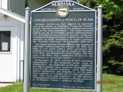
Congregational Church of Blair
The Congregational Church of Blair was organized with eight communicants on February 10, 1870, less than a year after John I. Blair auctioned the original town lots a few blocks north of this site. For a time, the Reverend Marshall Tingley, who had come from Sioux City, conducted services in the courthouse or in private homes.
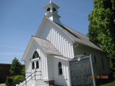
On November 22, 1874, a 28 by 40 foot sanctuary characteristic of the Carpenter-gothic style of architecture, was dedicated on this site. Additions and improvements have occurred throughout the years but the original structure, along with many interior furnishings, has remained in use for more than a century as a center for worship and fellowship. The style and simplicity of this pioneer Congregational Church provides a fitting memorial to Washington County's religious heritage.
Erected by First Congregational Church of Blair, Nebraska State Historical Society. (Marker Number 177.)
Topics and series. This historical marker is listed in these topic lists: Churches & Religion • Education • Notable Buildings • Settlements & Settlers. In addition, it is included in the Nebraska State Historical Society series list. A significant historical date for this entry is February 10, 1870.
Location. 41° 32.461′ N, 96° 8.168′ W. Marker is in Blair, Nebraska, in Washington County. Marker is at the intersection of S. 16th Street and Colfax Street, on the right when traveling south on S. 16th Street. Touch for map. Marker is at or near this postal address: 353 S 16th Street, Blair NE 68008, United States of America. Touch for directions.
Other nearby markers. At least 8 other markers are within 7 miles of this marker, measured as the crow flies. Lewis and Clark Campsites (approx. half a mile away); DeSoto Townsite (approx. 3˝ miles away); Cuming City Cemetery and Nature Preserve (approx. 3.8 miles away); Brewster Cemetery (approx. 4.2 miles away); Up the Missouri (approx. 5˝ miles away); The Lewis and Clark Expedition (approx. 5˝ miles away); Steamboat Bertrand (approx. 5.7 miles away); Lewis and Clark Campsite Area (approx. 7 miles away). Touch for a list and map of all markers in Blair.
Credits. This page was last revised on November 30, 2020. It was originally submitted on May 20, 2008, by Michael James of Fort Calhoun, Nebraska. This page has been viewed 1,374 times since then and 13 times this year. Photos: 1, 2. submitted on May 20, 2008, by Michael James of Fort Calhoun, Nebraska. • Kevin W. was the editor who published this page.

