Near Hawick in Kandiyohi County, Minnesota — The American Midwest (Upper Plains)
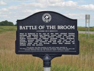
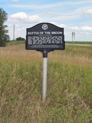
Battle of the Broom
Erected by the State of Minnesota through the Minnesota Historical Society and the Kandiyohi County Historical Society.
Topics. This historical marker is listed in these topic lists: Settlements & Settlers • Wars, US Indian. A significant historical year for this entry is 1860.
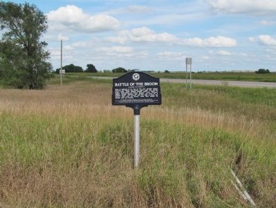
Location. 45° 21.001′ N, 94° 49.489′ W. Marker is near Hawick, Minnesota, in Kandiyohi County. Marker is at the intersection of 160th Street Northeast and State Highway 23, on the right when traveling west on 160th Street Northeast. Marker is approximately eight driving miles northeast of New London. Touch for map. Marker is in this post office area: New London MN 56273, United States of America. Touch for directions.
Other nearby markers. At least 8 other markers are within 7 miles of this marker, measured as the crow flies. Cape Bad Luck (approx. 2.6 miles away); Threshing Crew Attacked (approx. 3 miles away); Veterans Memorial (approx. 4.1 miles away); Indian Camp (approx. 5.9 miles away); How Irving Township Got Its Start (approx. 6 miles away); First Missionary (approx. 6.3 miles away); Federal Fish Hatchery (approx. 6.7 miles away); Robert lhlang Post 537, The American Legion (approx. 6.7 miles away).
More about this marker. The marker has the Historic Site seal of the Kandiyohi County Historical Society · 1895.
Regarding Battle of the Broom. Ojibwe (Chippewa) and Dakota (Sioux) nations had a long history of conflict for the control of the abundant natural resources in what is now Minnesota. (Minnesota became the 32nd state May 11, 1858.)
Also see . . .
1. Ojibwe. Wikipedia entry. (Submitted on October 31, 2014.)
2. Sioux. Wikipedia entry. (Submitted on October 31, 2014.)
3. Battle of the Brule. Wikipedia entry. "...the Battle of the Brule was an example of the type of ongoing conflict the two nations were engaged in during the 18th and early 19th centuries. This continued warfare between the Dakota and Ojibwe figured heavily in U.S. government policy in the Wisconsin Territory. The Treaty of Prairie du Chien (1825) had been arranged with the pretext of creating peace between the two nations, and in later treaties and negotiations the government repeatedly demanded the two groups end hostilities so white settlers would see Wisconsin as a peaceful region." (Submitted on October 31, 2014.)
4. The Ojibwe Native Americans. "The Ojibwe had little conflict with the United States during their reign, even after Fort Snelling was built in Minnesota to try to section off the Dakota from the Ojibwe. This may have been because they knew they had little chance of victory over the numerous, technologically advanced settlers. Although they presented little direct problem to the whites, they still went on attacking the Dakota as the hostilities between the two tribes continued on." (Submitted on October 31, 2014.)
5. Ojibwe and Sioux Beginnings. The Sioux Massacre at Fort St. Charles, 1736. "After the massacre... French traders at La Pointe tried to halt the fighting, but this had been coming for years, and neither the Dakota nor the Ojibwe would listen. The war was on, and this was just the beginning." (Submitted on October 31, 2014.)
Credits. This page was last revised on June 7, 2021. It was originally submitted on October 31, 2014, by Keith L of Wisconsin Rapids, Wisconsin. This page has been viewed 1,520 times since then and 233 times this year. Photos: 1, 2, 3. submitted on October 31, 2014, by Keith L of Wisconsin Rapids, Wisconsin.


