Annapolis Royal in Annapolis County, Nova Scotia — The Atlantic Provinces (North America)
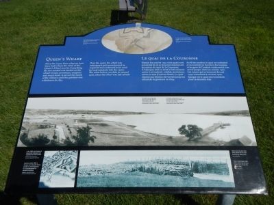
Queen’s Wharf
Le Quai de la Couronne

Photographed By Barry Swackhamer, June 17, 2014
1. Queen’s Wharf Marker
Captions (English / French): (top)The wharf was originally constructed as part of a major expansion project at the fort. / À l’origine, le quai construit dans le dare d’un grand projet d’expansion du fort.; (center) The wharf’s last configuration, shown around 1908, Note the small slipway at the end. / La dernière configuration du quai, vers 1908. Remarquez la petite rampe de mise à l’eau au bout.; (bottom, left) In the 1860’s, the Province of Nova Scotia redesigned and expanded the Queen’s Wharf. / Dans les années 1860, la Province de la Nouvelle-Écosse procède au réaménagement et à l’agrandissement du quai de la Couronne.; (bottom, right) Taken at low tide, this photo clearly shows the two cross pieces of the 1860s wharf. / Prise à marée basse, cette photo montre bien les deux sections en T du quai des années 1860.
Since the 1740s, three wharves have been built where the ruins of the Queen’s Wharf now lie. Everything the fort needed was landed on the wharf: troops, provisions, weapons and much more. It served the needs of the military until the garrison was withdrawn in 1854.
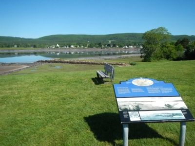
Over the years, the wharf was redesigned and reconstructed as required and continued to be used by local residents into the 1900s. The ruins before you date to around 1906, when the wharf was last rebuilt.
French
Depuis les années 1740, trois quais sont construits là oû se trouvent maintenant les ruines du quai de la Couronne. À l’époque, tout ce dont le fort a besoin arrive à cet endroit: soldats, provisions, armes et tant d’autres choses. Le quai répond aux besoins de l’armée jusqu’au retrait de la garnison en 1854.
Au fil des années, le quai est redessiné et reconstruit en fonction des besoins, et les gens de l’endroit continuent à s’en servir jusque dans les années 1900. Les ruines que se trouvent devant vous remontent â environ 1906, époque où le quai est reconstruit pour la dernière fois.
Topics. This historical marker is listed in this topic list: Waterways & Vessels. A significant historical year for this entry is 1854.
Location. 44° 44.529′ N, 65° 31.173′ W. Marker is in Annapolis Royal, Nova Scotia, in Annapolis County. Marker can be reached from St. George Street close to St. Anthony Street, on the left when traveling west. Touch for map. Marker is at or near this postal address: 323 St George Street, Annapolis Royal NS B0S, Canada. Touch for directions.
Other nearby markers. At least 8 other markers are within walking distance of this marker. Port-Royal (within shouting distance of this marker); Sieur de Monts (within shouting distance of this marker); The Black Hole / Le cachot (within shouting distance of this marker); The Flag Bastion (within shouting distance of this marker); William Wolseley (about 90 meters away, measured in a direct line); Samuel Vetch (about 90 meters away); Captures of Port Royal (about 90 meters away); Daniel Auger de Subercase (about 90 meters away). Touch for a list and map of all markers in Annapolis Royal.
More about this marker. This marker is located on the grounds of Fort Anne National Historic Site.
Credits. This page was last revised on June 16, 2016. It was originally submitted on November 1, 2014, by Barry Swackhamer of Brentwood, California. This page has been viewed 527 times since then and 18 times this year. Photos: 1, 2. submitted on November 1, 2014, by Barry Swackhamer of Brentwood, California. • Andrew Ruppenstein was the editor who published this page.
