Gilchrist in Galveston County, Texas — The American South (West South Central)
Rollover Fish Pass
The commission's purposes in constructing this pass were to introduce into East Bay sufficient quantities of sea water to increase bay water salinity, and to provide additional opportunity for travel of marine fish to and from spawning and feeding areas in the bay.
Lower salinity in East Bay was caused by the discharge of several fresh water streams into the area on the mainland side of the peninsula. This excessive fresh water not only limited the existence of marine fish but also restricted the growth of submerged vegetation, which provides nursery areas and forms the basis of the food cycle for marine life.
Creation of Rollover Fish Pass has greatly improved salt water fishing conditions for the thousands of sportsmen who flock to East Bay throughout the year.
Known as Rollover long before the Texas Game and Fish Commission constructed the fish pass, this site has a history steeped in legend dating back to the days of the Spaniards and continuing through the American prohibition period.
According to legend, it was first called Rollover because certain early ship captains preferring to avoid contact with the customs station at Galveston would roll barrels of imported merchandise from the Gulf side of Bolivar Peninsula over to East Bay. From there the barrels were transferred to the mainland without further formality.
The same rolling procedure - in reverse - also is said to have been used for selected items of export.
Erected 1963 by Texas Game and Fish Commission.
Topics. This historical marker is listed in these topic lists: Hispanic Americans • Man-Made Features • Waterways & Vessels. A significant historical year for this entry is 1955.
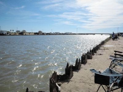
Location. Marker has been reported missing. It was located near 29° 30.498′ N, 94° 30.051′ W. Marker was in Gilchrist, Texas, in Galveston County. Marker could be reached from State Highway 87 north of North Bauer Lane, on the left when traveling north. Marker is located on the northwest side of Rollover Pass. Touch for map. Marker was in this post office area: Gilchrist TX 77617, United States of America. Touch for directions.
Other nearby markers. At least 7 other markers are within 18 miles of this location, measured as the crow flies. Charles Cronea (approx. 7.2 miles away); High Island (approx. 7.4 miles away); Crenshaw Family Cemetery (approx. 12.7
miles away); Double Bayou Dance Hall (approx. 14.3 miles away); St. Paul United Methodist Church (approx. 14.8 miles away); Graydon (approx. 16.4 miles away); Birthplace of Governor Ross Shaw Sterling (1875-1949) (approx. 17˝ miles away).
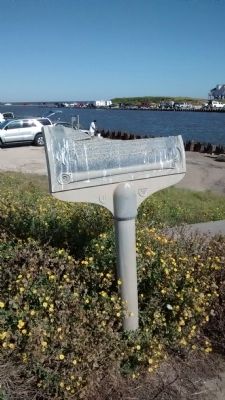
More about this marker. Marker was most likely destroyed in hurricane Ike in 2008. A bottom part of marker inscription is still extant. The Texas Historical Commission records a marker by the same title, and is noted as having been reported missing, but the text as recorded by THC does not match the remaining text on this marker. Photos of this marker before being destroyed are available on the internet.
Also see . . . Photo of marker before having been destroyed. (Submitted on November 3, 2014, by Richard Denney of Austin, Texas.)
Credits. This page was last revised on June 16, 2016. It was originally submitted on November 3, 2014, by Richard Denney of Austin, Texas. This page has been viewed 735 times since then and 35 times this year. Photos: 1, 2. submitted on November 3, 2014, by Richard Denney of Austin, Texas. • Bernard Fisher was the editor who published this page.

