Chiriaco Summit in Riverside County, California — The American West (Pacific Coastal)
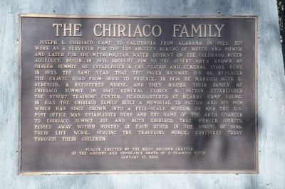
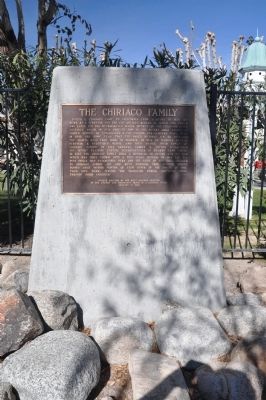
The Chiriaco Family
Erected 2003 by Billy Holcomb Chapter No. 1069, E Clampus Vitus. (Marker Number 113.)
Topics and series. This historical marker is listed in these topic lists: Industry & Commerce • Settlements & Settlers . In addition, it is included in the Desert Training Center, and the E Clampus Vitus series lists. A significant historical year for this entry is 1925.
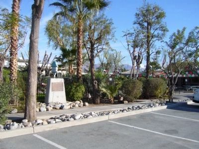
Location. 33° 39.665′ N, 115° 43.274′ W. Marker is in Chiriaco Summit, California, in Riverside County. Marker is on Chiriaco Road, on the right when traveling east. Marker is in front of the Chiriaco family home on the west side of the restaurant. The General Patton Memorial Museum is to the west and the Chiriaco Airstrip is to the east. Touch for map. Marker is at or near this postal address: 62450 Chiriaco Road, Indio CA 92201, United States of America. Touch for directions.
Other nearby markers. At least 8 other markers are within walking distance of this marker. Site of Contractors General Hospital (within shouting distance of this marker); Romero Pass (within shouting distance of this marker); Catapults (within shouting distance of this marker); Scythed Chariots (within shouting distance of this marker); Cannons (within shouting distance of this marker); 33-barreled Organs (within shouting distance of this marker); Coachella Valley Recipients (about 500 feet away, measured in a direct line); California-Arizona Maneuver Area (about 500 feet away). Touch for a list and map of all markers in Chiriaco Summit.
Regarding The Chiriaco Family. [Chiriaco Summit]
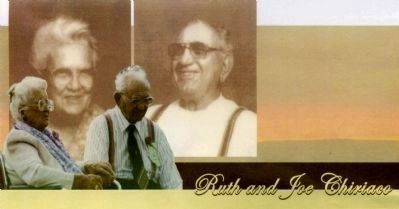
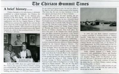
Little did Joseph Chiriaco know what was in store for him in the desert of California when he moved here from Alabama in 1925. When General Patton moved into the Camp Young area he paid the Chiriaco family for land taken as well as land used. Shaver's Summit became Chiriaco Summit officially in 1977 to avoid confusion between the two names. Joseph Chiriaco's store/restaurant/gas station serve the public to this day. SOURCE: Billy Holcomb Chapter 1069 35th Anniversary Plaque Book by Phillip Holdaway
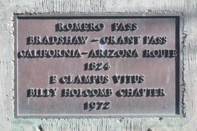
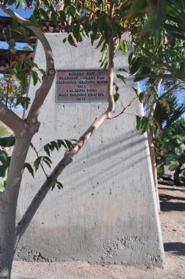
[Romero Pass]
Shaver's Summit was renamed Chiriaco Summit after Joseph L. Chiriaco established a gas station and store in 1934. Joseph Chiriaco first came to the desert as a surveyor for the future route of the Colorado River Aqueduct. When General Patton chose this area as his W.W. II training headquarters the Chiriaco business flourished. In the early 1820's Captain Jose Romero and a body of soldiers traveled from Mission San Gabriel to Sonora, Mexico in an unsuccessful attempt to open a land route through San Gorgonio Pass to Tucson. Later the Bradshaw trail followed Indian trails through the pass. SOURCE: Billy Holcomb Chapter 1069 35th Anniversary Plaque Book by Phillip Holdaway
Credits. This page was last revised on June 16, 2016. It was originally submitted on December 20, 2011, by Michael Kindig of Elk Grove, California. This page has been viewed 1,241 times since then and 109 times this year. Last updated on November 3, 2014, by Michael Kindig of Elk Grove, California. Photos: 1. submitted on December 20, 2011, by Michael Kindig of Elk Grove, California. 2, 3. submitted on December 25, 2011, by Michael Kindig of Elk Grove, California. 4. submitted on December 24, 2012, by Bill Kirchner of Tucson, Arizona. 5. submitted on December 23, 2011, by Michael Kindig of Elk Grove, California. 6, 7, 8, 9. submitted on December 26, 2011, by Michael Kindig of Elk Grove, California. 10. submitted on March 31, 2014, by Michael Kindig of Elk Grove, California. • Bill Pfingsten was the editor who published this page.
