Grand Canyon National Park in Coconino County, Arizona — The American Mountains (Southwest)
Trans-Canyon Telephone Line
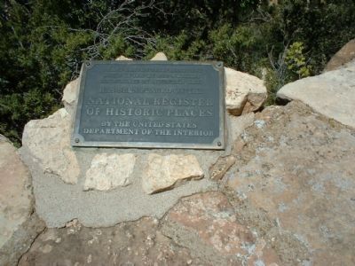
Trans-Canyon Telephone Line, built in 1935 by CCC workers, maintained by Mountain Bell, has been placed on the National Register of Historic Places by the United States Department of the Interior.
Erected by National Park Service.
Topics and series. This historical marker is listed in these topic lists: Communications • Industry & Commerce. In addition, it is included in the Civilian Conservation Corps (CCC) series list. A significant historical year for this entry is 1935.
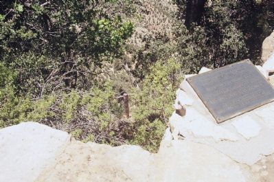
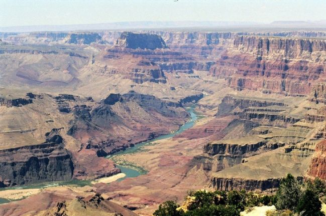
Location. 36° 3.427′ N, 112° 8.343′ W. Marker is in Grand Canyon National Park, Arizona, in Coconino County. Grand Canyon along Bright Angel & North Kaibab Trails from South Rim to Roaring Springs & South Kaibab Trail to Tipoff. Walking along the paved walk-way between the El Tovar and the Bright Angel Lodges you encounter this plaque. Touch for map. Marker is in this post office area: Grand Canyon AZ 86023, United States of America. Touch for directions.
Other nearby markers. At least 8 other markers are within walking distance of this marker. CCC Legacy (a few steps from this marker); Bright Angel Lodge (about 400 feet away, measured in a direct line); a different marker also named Bright Angel Lodge (about 500 feet away); Lookout Studio (about 500 feet away); Buckey O'Neill Cabin (about 500 feet away); El Tovar Hotel (about 600 feet away); Hopi House (about 600 feet away); a different marker also named El Tovar Hotel (about 600 feet away). Touch for a list and map of all markers in Grand Canyon National Park.
More about this marker. CCC stands for the Civilian Conservation Corps, a work relief program for young unemployed men established in 1933 during the Great Depression by President Franklin D. Roosevelt. Mountain Bell was the trade name of the The Mountain States Telephone & Telegraph Company, the American Telephone and Telegraph-owned company that did business in a number of western states including Arizona. Today this telephone company is known as Quest Communications International.
Regarding Trans-Canyon Telephone Line. National Register of Historic Places:
Trans-Canyon Telephone Line, Grand Canyon National Park(added 1986 - - #86001102)
Also known as Emergency Telephone Line, Grand Canyon National Park
♦ Grand Canyon along Bright Angel & North Kaibab Trails from South Rim to Roaring Springs & South Kaibab Trail to Tipoff , Grand Canyon
♦ Historic Significance: Event, Architecture/Engineering •
♦ Architect, builder, or engineer: National Park Service, Civilian Conservation Corps
♦ Architectural Style: Other
♦ Area of Significance: Politics/Government, Engineering, Architecture
♦ Period of Significance: 1925-1949
♦ Owner: Private
♦ Historic Function: Industry/Processing/Extraction
♦ Historic Sub-function: Communications Facility
♦ Current Function: Industry/Processing/Extraction
♦ Current Sub-function: Communications Facility
♦ Construction System Metal, Copper
♦ Architectural Style Open-wire Copper weld
Also see . . . additional Pics. (Submitted on January 3, 2008, by Mike Stroud of Bluffton, South Carolina.)
Additional commentary.
1. Notes
This line is also known as Emergency Telephone Line, Grand Canyon National Park.
— Submitted January 3, 2008, by Mike Stroud of Bluffton, South Carolina.
Credits. This page was last revised on March 23, 2022. It was originally submitted on January 3, 2008, by Mike Stroud of Bluffton, South Carolina. This page has been viewed 2,895 times since then and 28 times this year. Last updated on November 12, 2014, by Kevin Craft of Bedford, Quebec. Photos: 1, 2, 3. submitted on January 3, 2008, by Mike Stroud of Bluffton, South Carolina. • Syd Whittle was the editor who published this page.


