Tucumcari in Quay County, New Mexico — The American Mountains (Southwest)
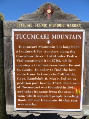
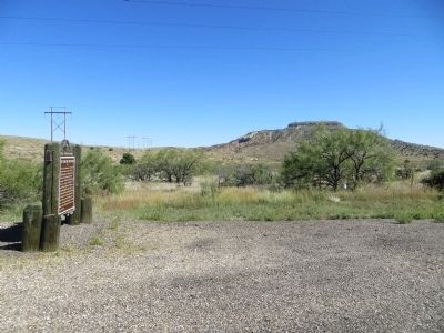
Tucumcari Mountain
Erected by New Mexico Historic Preservation Division.
Topics and series. This historical marker is listed in these topic lists: Roads & Vehicles • Settlements & Settlers. In addition, it is included in the U.S. Route 66 series list. A significant historical year for this entry is 1793.
Location. 35° 8.549′ N, 103° 43.492′ W. Marker is in Tucumcari, New Mexico, in Quay County. Marker is on State Road 209, half a mile south of Interstate 40, on the left when traveling south. Touch for map. Marker is in this post office area: Tucumcari NM 88401, United States of America. Touch for directions.
Other nearby markers. At least 8 other markers are within 3 miles of this marker, measured as the crow flies. A Route 66 Classic (approx. 2.1 miles away); Blue Swallow Motel (approx. 2.1 miles away); Comanche Country (approx. 2.2 miles away); Yetta Kohn (1843 – 1917) (approx. 2.3 miles away); a different marker also named Tucumcari Mountain (approx. 2˝ miles away); Fort Bascom (approx. 2˝ miles away); a different marker also named Tucumcari Mountain (approx. 2.7 miles away); Tucumcari (approx. 2.7 miles away). Touch for a list and map of all markers in Tucumcari.

Photographed By Bill Kirchner, October 5, 2014
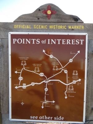
2. Back of Tucumcari Mountain Marker
Points of Interest
New Mexico's Historic Markers typically have a map on the back side showing the location of other OSHM's. This is an excellent source of information when exploring for other Historical Markers and locations.
New Mexico's Historic Markers typically have a map on the back side showing the location of other OSHM's. This is an excellent source of information when exploring for other Historical Markers and locations.
Credits. This page was last revised on July 9, 2018. It was originally submitted on November 14, 2014, by Bill Kirchner of Tucson, Arizona. This page has been viewed 603 times since then and 25 times this year. Last updated on July 9, 2018, by Craig Baker of Sylmar, California. Photos: 1, 2, 3. submitted on November 14, 2014, by Bill Kirchner of Tucson, Arizona. • Syd Whittle was the editor who published this page.

