Blue Rapids in Marshall County, Kansas — The American Midwest (Upper Plains)
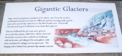
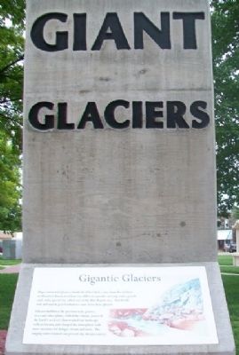
Gigantic Glaciers
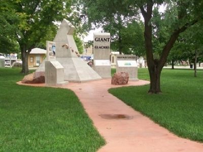
The Monument to the Ice Age
— Blue Rapids, Kansas —
Huge continental glaciers, hundreds of feet thick, came from the north to northeastern Kansas in at least two different episodes carrying rocks, gravel, sand, and a special clay called loess to the Blue Rapids area. Our fertile soils and sand & gravel industries came from these glaciers.
Glaciers bulldozed the previous soils, grasses, trees and other plants, chilled the climate, lowered the Earth's sea level, then washed our landscape with meltwater, and charged the atmosphere with more moisture for deluges of rain and snow. The surging water formed our present-day stream courses.
Erected 2012 by George Callison and Concerned Blue Rapids Citizens and Organizations.
Topics. This historical marker is listed in these topic lists: Environment • Paleontology.
Location. 39° 40.896′ N, 96° 39.568′ W. Marker is in Blue Rapids, Kansas, in Marshall County. Marker is at the intersection of Main Street and 6th Street, on the left when traveling south on Main Street. Marker is on the Public Square. Touch for map. Marker is in this post office area: Blue Rapids KS 66411, United States of America. Touch for directions.
Other nearby markers. At least 8 other markers are within walking distance of this marker. Oldest Rocks in Kansas (here, next to this marker); Ice Age (here, next to this marker); War Memorial (a few steps from this marker); Historic Holm Cabin (within shouting distance of this marker); Blue Rapids Public Library (about 300 feet away, measured in a direct line); Blue Rapids Station Bell (about 600 feet away); Oldest Roundabout in Kansas (about 600 feet away); Historical Baseball Game (approx. 0.4 miles away). Touch for a list and map of all markers in Blue Rapids.
Also see . . .
1. Blue Rapids revives Ice Age Monument. (Submitted on November 16, 2014, by William Fischer, Jr. of Scranton, Pennsylvania.)
2. Ice Age Monument dedicated (The Blue Rapids Historical Society). (Submitted on November 16, 2014, by William Fischer, Jr. of Scranton, Pennsylvania.)
3. General Overview of the Ice Ages. (Submitted on November 16, 2014, by William Fischer, Jr. of Scranton, Pennsylvania.)
4. USGS: The Great Ice Age. (Submitted on November 16, 2014, by William Fischer, Jr. of Scranton, Pennsylvania.)
Credits. This page was last revised on June 16, 2016. It was originally submitted on November 16, 2014, by William Fischer, Jr. of Scranton, Pennsylvania. This page has been viewed 418 times since then and 11 times this year. Photos: 1, 2, 3. submitted on November 16, 2014, by William Fischer, Jr. of Scranton, Pennsylvania.


