Near Millville in Jefferson County, West Virginia — The American South (Appalachia)
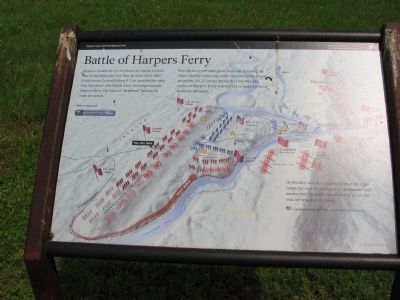
Battle of Harpers Ferry
Harpers Ferry National Historical Park
— National Park Service, U.S. Department of the Interior —
Here Jackson overcame the great obstacles, defeating the Union during a three-day battle and forcing the largest surrender of U.S. troops during the Civil War. His victory at Harpers Ferry enabled Lee to make his stand at nearby Antietam.
At first their missiles of death fell far short of our camp; but each succeeding shell came nearer and nearer, until the earth was plowed up at our feet and our tents torn to tatters.
Lieutenant James H. Clark, 115th New York Infantry
Erected by National Park Service, U.S. Department of the Interior.
Topics. This historical marker is listed in this topic list: War, US Civil. A significant historical month for this entry is September 1862.
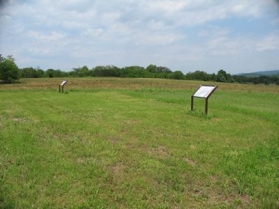
Location. 39° 18.961′ N, 77° 46.773′ W. Marker is near Millville, West Virginia, in Jefferson County. Marker can be reached from Bloomery Road (County Road 27), on the right when traveling south. Located in the south section of the School House Ridge unit of the Harpers Ferry National Historic Park. The marker is along a walking trail just south of the William L. Wilson Freeway (US 340). The trail is best reached from the parking area on Bloomary Road (CR 27). Touch for map. Marker is in this post office area: Millville WV 25432, United States of America. Touch for directions.
Other nearby markers. At least 8 other markers are within walking distance of this marker. Flag Talk (a few steps from this marker); Fake Attack - September 14th (approx. 0.3 miles away); Destined for Antietam (approx. 0.3 miles away); Allstadt House (approx. 0.4 miles away); Confederates Converge (approx. 0.4 miles away); Assessing the Obstacle (approx. 0.4 miles away); Battle of Harpers Ferry / Jackson Arrives (approx. half a mile away); No Man's Land (approx. half a mile away). Touch for a list and map of all markers in Millville.
More about this marker. The background of the marker is a three dimensional map showing the major actions of the Battle of Harpers Ferry. Areas under bombardment are indicated by yellow stars.
Related markers. Click here for a list of markers that are related to this marker. Markers along Schoolhouse Ridge related to the Civil War activity in Harpers Ferry.
Also see . . . 1862 Battle of Harpers Ferry. National Park Service summary of the battle. (Submitted on May 26, 2008, by Craig Swain of Leesburg, Virginia.)

Photographed By Craig Swain, May 17, 2008
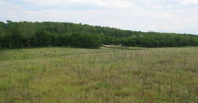
3. South End of School House Ridge Trail
South of US 340, the School House Ridge unit is a recent addition to the Harpers Ferry Historical Park. The small parking lot along Bloomary Road supports two trails covering the southern section of the ridge, from the highway south to the Shenandoah River. The high wooded ground on the other side of the road, in the distance, is the southern end of Bolivar Heights. This section of Bolivar Heights was not fortified during the 1862 battle, but was during later Federal occupations.

Photographed By Craig Swain, May 17, 2008
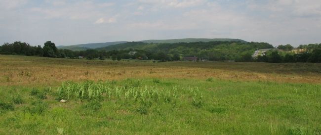
4. Confederate Bombardment
Looking from the marker location toward the east at Bolivar Heights. US 340 crosses the Heights in the center distance. Trimble's Confederate infantry Brigade of Lawton's Division occupied the ridge in the general area of the marker. Artillery pieces posted here bombarded Federal lines on Bolivar Heights, starting on September 14, 1862. Later three pieces were advanced forward toward the uncovered section of Bolivar Heights to fire on the Federal flanks.
Credits. This page was last revised on June 12, 2020. It was originally submitted on May 26, 2008, by Craig Swain of Leesburg, Virginia. This page has been viewed 1,479 times since then and 15 times this year. Photos: 1, 2, 3, 4. submitted on May 26, 2008, by Craig Swain of Leesburg, Virginia.

