St. Joseph in Buchanan County, Missouri — The American Midwest (Upper Plains)
St. Joseph
The Union's Linchpin to the West
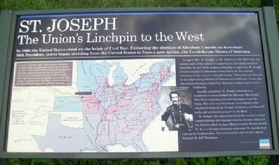
In 1860, the United States stood on the brink of Civil War. Following the election of Abraham Lincoln as America's 16th President, states began seceding from the United States to form a new nation, the Confederate States of America.
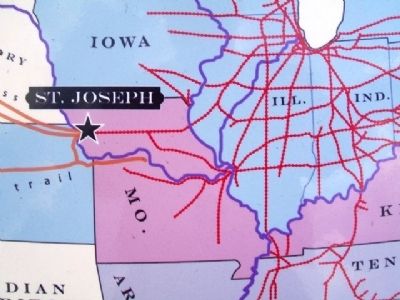
In April 1861, St. Joseph, as the "Gateway to the West" was the central point of the nation's transportation and communications networks. As part of the modern technology to wage war. St. Joseph became singularly important to the North as the western terminus of the nation's railroad system. This vital rail link led to the important goldfields of Colorado and California. It was also the eastern terminus of the Pony Express overland mail route to California.
Equally important, St. Joseph's location as a steamboat terminus linked the Missouri-Mississippi-Ohio River waterways for river passage across the North. The rails and steamboats here linked to the complex of trails of the Oregon, California and Santa Fe trails and overland transport to the West.
St. Joseph, the central hub of all the country's major communication and transport routes, became critical to the North's effort to place Missouri under Union control. To do so it became necessary to protect St. Joseph from capture by Confederates, who included the city's former mayor General M. Jeff Thompson.
[Map inset text]
Missouri, a border state, voted against secession in March 1861 and attempted to remain a neutral member of the United States. Missourians declared that they would not provide men or supplies to either side. In these first months of the Civil War, securing Missouri with its abundant resources was critical to the Northern war effort. Union control of St. Joseph became key to its ultimate success.
Erected 2014 by Missouri Humanities Council and Many Other Donors.
Topics. This historical marker is listed in these topic lists: Communications • Settlements & Settlers • War, US Civil • Waterways & Vessels. A significant historical month for this entry is March 1861.
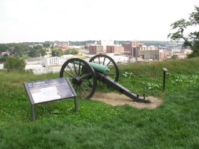
Location. 39° 46.365′ N, 94° 51.747′ W. Marker is in St. Joseph, Missouri, in Buchanan County. Marker is in Fort Smith Park, on Prospect Hill, accessed from Bellevue and Michel Streets. Touch for map. Marker is in this post office area: Saint Joseph MO 64501, United States of America. Touch for directions.
Other nearby markers. At least 8 other markers are within walking distance of this marker. Fort Smith (within shouting distance of this marker); A Path To Freedom (within shouting distance of this marker); The Men of the Corps of Discovery / The Lewis and Clark Expedition (approx. 0.4 miles away); Pony Express (approx. half a mile away); Joseph Robidoux (approx. half a mile away); The California - Oregon Trail (approx. half a mile away); St. Michael's Prairie / The Lewis and Clark Expedition (approx. half a mile away); Buchanan County Courthouse (approx. half a mile away). Touch for a list and map of all markers in St. Joseph.
Also see . . . Fort Smith Park, St. Joseph MO. St. Joseph Missouri website entry (Submitted on November 30, 2014, by William Fischer, Jr. of Scranton, Pennsylvania.)
Credits. This page was last revised on April 26, 2022. It was originally submitted on November 30, 2014, by William Fischer, Jr. of Scranton, Pennsylvania. This page has been viewed 563 times since then and 23 times this year. Photos: 1, 2, 3, 4, 5. submitted on November 30, 2014, by William Fischer, Jr. of Scranton, Pennsylvania.
