Near Alexandria in Fairfax County, Virginia — The American South (Mid-Atlantic)
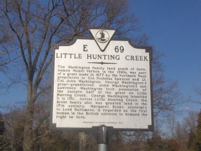
Little Hunting Creek
Erected 1999 by Department of Historic Resources. (Marker Number E-69.)
Topics and series. This historical marker is listed in these topic lists: Colonial Era • Waterways & Vessels. In addition, it is included in the Former U.S. Presidents: #01 George Washington, and the Virginia Department of Historic Resources (DHR) series lists. A significant historical year for this entry is 1677.
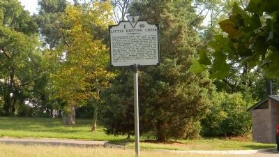
Location. 38° 42.646′ N, 77° 4.338′ W. Marker is near Alexandria, Virginia, in Fairfax County. Marker is at the intersection of George Washington Memorial Parkway (at milepost 1) and Stratford Lane, on the right when traveling east on George Washington Memorial Parkway. Marker is located in parking lot of Riverside Park which is across from Stratford Lane intersection with the George Washington Memorial Parkway. Touch for map. Marker is in this post office area: Alexandria VA 22308, United States of America. Touch for directions.
Other nearby markers. At least 5 other markers are within walking distance of this marker. George Washington, Farmer (within shouting distance of this marker); The Thirteen Adjacent Elms (about 300 feet away, measured in a direct line); Park and Parkway (approx. ¾ mile away); The Mount Vernon Memorial Highway (approx. ¾ mile away); Origin of the Purple Heart Trail (approx. ¾ mile away). Touch for a list and map of all markers in Alexandria.
More about this marker. In the 1930s a marker with this same title and number stood 3½ miles away on U.S. Route 1 where it crosses over Little Hunting Creek, a few hundred feet north of the northernmost intersection with Mount Vernon Highway (State Route 235). The text of the original marker read Margaret Brent, secretary to Lord Baltimore, the first woman in American to demand a vote, patented land here in 1663. Augustine Washington lived here from 1734 to 1739, and here George Washington passed most of his infancy.
Also see . . .
1. George Washington Birthplace: Johhn Washington history. (Submitted on December 26, 2006, by Roger Dean Meyer of Yankton, South Dakota.)
2. Margaret Brent: A Woman of Property. (Submitted on December 26, 2006, by Roger Dean Meyer of Yankton, South Dakota.)
3. George Washington's Mount Vernon Estate and Gardens. (Submitted on December 26, 2006, by Roger Dean Meyer of Yankton, South Dakota.)
Credits. This page was last revised on August 6, 2020. It was originally submitted on December 26, 2006, by Roger Dean Meyer of Yankton, South Dakota. This page has been viewed 1,950 times since then and 34 times this year. Photos: 1. submitted on December 26, 2006, by Roger Dean Meyer of Yankton, South Dakota. 2, 3. submitted on August 16, 2011, by Richard E. Miller of Oxon Hill, Maryland. • J. J. Prats was the editor who published this page.


