Tallahassee in Leon County, Florida — The American South (South Atlantic)
The Mission Of San Pedro y San Pablo de Patale
Inscription.
Side 1
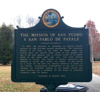
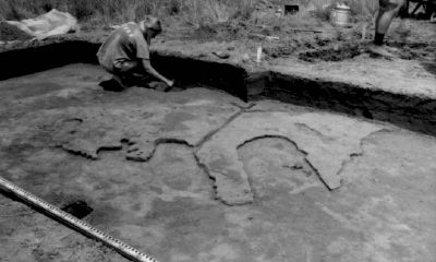
In 1633, the province of Apalachee in Spanish Florida received its first full-time resident missionaries. The Franciscan Mission of San Pedro y San Pablo de Patale which was located about one hundred yards north of this marker was one of the first missions with a resident priest to be established in the region after that date. Like other Spanish missions in Florida, this outpost of Spanish domination was designed to convert and "civilize" the Indians. It also served as a center for the civil and military authority of Spain on the frontier. Archeological investigations at the site in 1971 revealed the structural remains of the mission church and other buildings and a cemetery for the burial of Christians containing some 64 graves.
Side 2
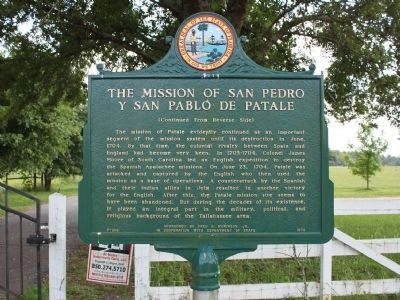
The mission of Patale evidently continued as an important segment of the mission system until its destruction in June, 1704. By that time, the colonial rivalry between Spain and England had become very keen. In 1703-1704, Colonel James Moore of South Carolina led an English expedition to destroy the Spanish Apalachee missions. On June 23, 1704, Patale was attacked and captured by the English who then used the mission as a base of operations. A counterattack by the Spanish and their Indian allies in July resulted in another victory for the English. After this, the Patale mission site seems to have been abandoned. But during the decades of its existence, it played an integral part in the military, political, and religious background of the Tallahassee area.
Erected 1973 by Fred O. Dickinson, Jr. In Cooperation With Department of State. (Marker Number F-209.)
Topics. This historical marker is listed in these topic lists: Churches & Religion • Colonial Era • Native Americans • Settlements & Settlers. A significant historical month for this entry is June 1704.
Location. 30° 28.001′ N, 84° 9.007′ W. Marker is in Tallahassee, Florida, in Leon County. Marker is on Spanish Mission Court, 0.2 miles north of Buck Lake Road, on the left when traveling north. Marker located on private property, inside a locked fence. Cannot view the reverse side of marker. Touch for map. Marker is at or near this postal address: 566 Spanish Mission Court, Tallahassee FL 32317, United States of America. Touch for directions.
Other nearby markers. At least 8 other markers are within 5 miles of this marker, measured as the crow flies. Munree (Fleischmann) Cemetery of Welaunee Plantation (approx. 2.6 miles away); Chaires Historic District (approx. 2.7 miles away); Under Cover of Corn (approx. 3.1 miles away); Tallahassee National Cemetery Carillon
(approx. 3.7 miles away); Tallahassee National Cemetery (approx. 3.7 miles away); Hickory Hill Cemetery of Welaunee Plantation (approx. 3.7 miles away); The "Luraville Locomotive" (approx. 4.8 miles away); a different marker also named The Luraville Locomotive (approx. 4.8 miles away). Touch for a list and map of all markers in Tallahassee.
Also see . . . A Spanish Mission’s Brutal Past. Tallahassee Magazine website entry (Submitted on December 10, 2014, by Mark Hilton of Montgomery, Alabama.)
Credits. This page was last revised on September 3, 2021. It was originally submitted on December 10, 2014, by Mark Hilton of Montgomery, Alabama. This page has been viewed 954 times since then and 78 times this year. Photos: 1. submitted on December 10, 2014, by Mark Hilton of Montgomery, Alabama. 2. submitted on December 10, 2014, by Tim Fillmon of Webster, Florida. 3, 4. submitted on December 10, 2014, by Mark Hilton of Montgomery, Alabama.


