Middletown in Frederick County, Maryland — The American Northeast (Mid-Atlantic)
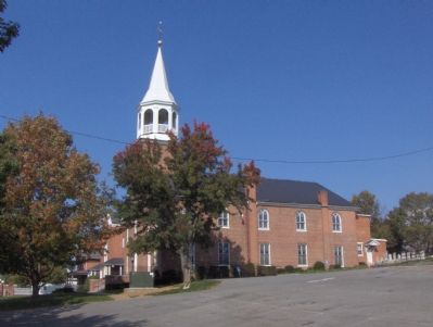
Christ Reformed Church
Just Before the Battle
— Antietam Campaign 1862 —
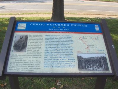
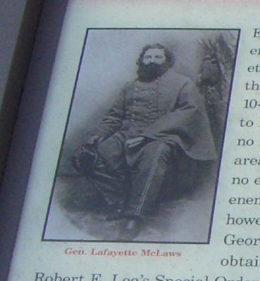
Eight thousand Confederates under Gen. Lafayette McLaws marched by this church on September 10-11, 1862, heading south to Harper’s Ferry. Since no Federals were in the area, McLaws expected no encounters with the enemy. Unknown to him, however, Union Gen. George B. McClellan had obtained a copy of Gen. Robert E. Lee’s Special Order 191 containing the Confederate plans; soon the rear of McLaws’ column was in danger.
Most of McClellan’s Army of the Potomac marched west on the National Road (present-day Alt. U.S. Rte. 40) on September 14, en route to the gaps of South Mountain. The steeple of the Reformed Church served as a Union observation station during the battle that followed.
“Waking stiff and sore to a beautiful Sunday morning [September 14], the first thought was breakfast. Some cattle were driven up and killed in the neighboring field, and we tried broiling dollops of steaming fresh beef upon our ramrods. Some of the men visited the houses in the town [Middletown] in search of eatables, but with little success. The irrepressible Walsh returned with a tea kettle and cabbage…and set to work boiling the vegetable. While this was passing, artillery fire commenced, and white puffs of smoke began to rise between us and the range of blue hills, called South Mountain…Two o’clock in the afternoon came, and with it the order to ‘fall in.’ Walsh had not time to cook his cabbage, so he slung it, kettle and all, to his belt, in hopes of a chance to finish it.” - From the regimental history of the 35th Massachusetts Infantry.
Erected by Maryland Civil War Trails.
Topics and series. This historical marker is listed in these topic lists: Notable Buildings • War, US Civil. In addition, it is included in the Maryland Civil War Trails series list. A significant historical month for this entry is September 1677.
Location. 39° 26.533′ N, 77° 32.724′ W. Marker is in Middletown, Maryland, in Frederick County. Marker is on South Church Street (Maryland Route 17) 0 miles south of Washington Street, on the left when traveling south. It is located in the parking lot of the Christ Reformed Church and Cemetery. Touch for map. Marker is at or near this postal address: 103 S Church St, Middletown MD 21769, United States of America. Touch for directions.
Other nearby markers. At least 8 other markers are within walking distance of this marker. Middletown (about 500 feet away, measured in a direct line); Memorial Hall (about 500 feet away); 8 West Main Street (about 600 feet away); The Coblentz-Long Building (about 600 feet away); Clovinger House (about 600 feet away); Main's Ice Cream Factory (about 600 feet away);
The Arnett Building (about 600 feet away); Valley Savings Bank (about 600 feet away). Touch for a list and map of all markers in Middletown.
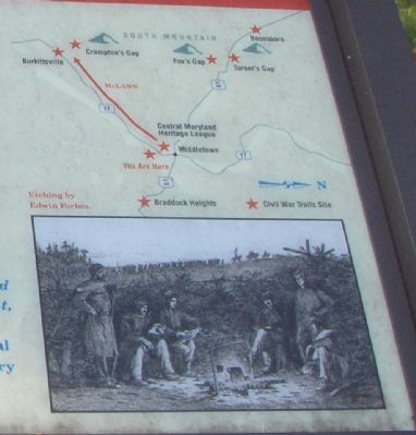
More about this marker. In the upper left is a portrait of General McLaws. A map on the upper right indicates key points involved with the Antietam Campaign, with other Civil War Trails sites pointed out with red stars. On the lower right is an etching by Edwin Forbes of soldiers around a campfire.
Regarding Christ Reformed Church. On Wikipedia, it is seen that McLaws commanded a division with this chain of command:
1st corps, James Longstreet
Army of Northern Virginia, Robert E. Lee
Also see . . . Lafayette McLaws. Wikipedia entry (Submitted on March 8, 2022, by Larry Gertner of New York, New York.)
Credits. This page was last revised on September 29, 2022. It was originally submitted on December 27, 2006, by Roger Dean Meyer of Yankton, South Dakota. This page has been viewed 2,386 times since then and 10 times this year. Last updated on February 14, 2021, by Carl Gordon Moore Jr. of North East, Maryland. Photos: 1. submitted on December 27, 2006, by Roger Dean Meyer of Yankton, South Dakota. 2. submitted on July 23, 2007, by Craig Swain of Leesburg, Virginia. 3, 4, 5. submitted on December 27, 2006, by Roger Dean Meyer of Yankton, South Dakota. • Bill Pfingsten was the editor who published this page.
