Lingle in Goshen County, Wyoming — The American West (Mountains)
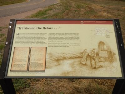
“If I Should Die Before…”
In September, 1862, Ezra Francis Martin recorded that his wife Sophia and young daughter Esther Jane died. The wagon train continued on until it reached Rawhide Creek where the wagon master permitted time for her to be laid to rest. Before breaking camp the next morning , two other children were also buried along the steam bank.
For most emigrants, once on the trail, there were no markets, no doctors, no laws, and no second chances. Until they reached the trail’s end, the pioneers were on their own.
(Journal entries, side-bar at bottom, left)
Many explores, emigrants, and pioneers kept diaries or journals of their 4-5 month trek across the prairies and mountains that provided us with insight into their experiences.
Heber C. Kimball, Monday May 31, 1847 - “We traveled till a quarter to 7 and then formed our encampment on the east bank of a shoal stream about 10 feet wide, and is doubtless the “Raw Hide” as stated by Mr. Grosclaude.
William Clayton, Tuesday, June 1, 1847 - “At nine o’clock we pursued our journey, the stream we passed over is called by Grosclaude: “The Raw Hide.”
Thomas Bullock May 31, 1847 - “A very fine day, clear sky. Gathered up cattle & started at 8:10 over a barren country yet abounding with Prickly Pears. I was taken very sick with Auge and Fever, & was obliged to relinquish driving my team to Conrad Klineman… we camped on “Raw Hide Creek” In the evening Doctor administered a Lobelia Emetic & attended me through the operation.
Ezra Francis Martin, September 2, 1862 - “the company crossed sand hills, the wind blew and it was cold - no fire and no supper. Sophia (Martin’s wife) is sick and full of pain.
September 11, 1862 - “Esther Jane Martin (daughter of Ezra and Sophia Martin) age 1 1/2 years died with a slight convulsion about twenty miles east of Laramie. Teamsters finally permitted time to bury her at Rawhide Creek 12 miles east of Fort Laramie.
Erected by Mormon Trail Heritage Foundation & National Park Service.
Topics and series. This historical marker is listed in these topic lists: Roads & Vehicles • Settlements & Settlers. In addition, it is included in the Mormon Pioneer Trail series list. A significant historical date for this entry is May 31, 1989.
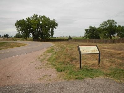
Location. 42° 7.507′ N, 104° 19.551′ W. Marker is in Lingle, Wyoming, in Goshen County. Marker is on U.S. 29/85 near Road 81, on the right when traveling west. Touch for map. Marker is in this post office area: Lingle WY 82223, United States of America. Touch for directions.
Other nearby markers. At least 8 other markers are within 9 miles of this marker, measured as the crow flies. Old Texas Trail (approx. 1.2 miles away); Mormon Pioneer Trail (approx. 1.3 miles away); Oregon Trail (approx. 2 miles away); The Grattan Fight (approx. 4.1 miles away); a different marker also named Oregon Trail (approx. 4.2 miles away); To All Pioneers (approx. 4.2 miles away); CPL. Travis Snow Memorial Building (approx. 8.4 miles away); Replica of the Statue of Liberty (approx. 8.4 miles away). Touch for a list and map of all markers in Lingle.
Credits. This page was last revised on June 16, 2016. It was originally submitted on December 17, 2014, by Barry Swackhamer of Brentwood, California. This page has been viewed 765 times since then and 25 times this year. Photos: 1, 2. submitted on December 17, 2014, by Barry Swackhamer of Brentwood, California. • Andrew Ruppenstein was the editor who published this page.

