Near Fort Laramie in Goshen County, Wyoming — The American West (Mountains)
Fort Laramie National Historic Site
Inscription.
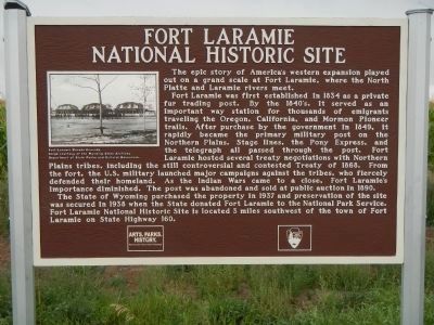
The epic story of America’s western expansion played out on a grand scale at Fort Laramie, where the North Platte and Laramie Rivers meet.
Fort Laramie was first established in 1834 as a private fur trading post. By the 1840’s, it served as an important way station for thousands of emigrants traveling the Oregon, California and Mormon Pioneer trails. After purchase by the government in 1849, it rapidly became the primary military post on the Northern Plains. Stage lines, the Pony Express, and the telegraph all passed through the post. Fort Laramie hosted several treaty negotiations with Northern Plains tribes, including the still controversial and contested Treaty of 1868. From the fort, the U.S. military launched major campaigns against the tribes, who fiercely defended their homeland. As the Indian Wars came to a close, Fort Laramie’s importance diminished. The post was abandoned and sold at public auction in 1890.
The State of Wyoming purchased the property in 1937 and preservation of the site was secured in 1938 when the State donated Fort Laramie to the National Park Service. Fort Laramie National Historic Site is located 3 miles southwest of the town of Fort Laramie on State Highway 160.
Erected by Wyoming State Parks & Cultural Resources & National Park Service.
Topics. This historical marker is listed in these topic lists: Forts and Castles • Roads & Vehicles. A significant historical year for this entry is 1834.
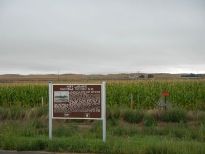
Location. 42° 13.007′ N, 104° 31.471′ W. Marker is near Fort Laramie, Wyoming, in Goshen County. Marker is on U.S. 26 near Otis Street, on the left when traveling north. Touch for map. Marker is in this post office area: Fort Laramie WY 82212, United States of America. Touch for directions.
Other nearby markers. At least 8 other markers are within 2 miles of this marker, measured as the crow flies. Mormon Pioneers at Fort Laramie (approx. half a mile away); Old Army Bridge Over the Platte River (approx. 0.6 miles away); Spanning a Century: End of an Era (approx. 0.7 miles away); Fort Platte (approx. 0.8 miles away); The Cavalry Stables (approx. 1.8 miles away); Noncommissioned Officers’ Quarters (approx. 1.8 miles away); ‘Where’s the Wall?’ (approx. 1.8 miles away); Handcarts – The New Plan (approx. 1.8 miles away). Touch for a list and map of all markers in Fort Laramie.
Also see . . . Fort Laramie National Historic Site - Wikipedia. Fort Laramie (originally founded as Fort William and then known for a while as Fort John) was a significant 19th century trading post and diplomatic site located at the confluence of the Laramie River and the North Platte River in the upper Platte River Valley in the eastern part of the U.S. state of Wyoming. Founded in the 1830s to service the overland fur trade during the middle 19th century, it sat at the bottom of the long climb leading to the best and lowest crossing point at South Pass into western descending valleys and so was a primary stopping point on the Oregon Trail. (Submitted on December 20, 2014, by Barry Swackhamer of Brentwood, California.)
Credits. This page was last revised on June 16, 2016. It was originally submitted on December 20, 2014, by Barry Swackhamer of Brentwood, California. This page has been viewed 661 times since then and 29 times this year. Photos: 1, 2. submitted on December 20, 2014, by Barry Swackhamer of Brentwood, California. • Andrew Ruppenstein was the editor who published this page.

