Guernsey in Platte County, Wyoming — The American West (Mountains)
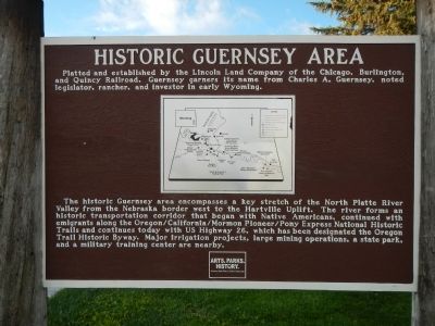
Historic Guernsey Area
The historic Guernsey area encompasses a key stretch of the North Platte River Valley from the Nebraska border west to the Hartville Uplift. The river forms an historic transportation corridor that began with the Native Americans, continued with emigrants along the Oregon/California/Mormon Pioneer/Pony Express National Historic Trails and continues today with US Highway 26, which has been designated the Oregon Trail Historic Byway. Major irrigation projects, large mining operations, a state park, and a military training center are nearby.
Erected by Wyoming State Parks & Cultural Resources & National Park Service.
Topics and series. This historical marker is listed in this topic list: Settlements & Settlers. In addition, it is included in the Oregon Trail series list.
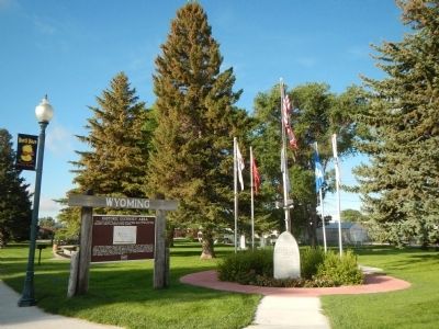
Location. 42° 16.181′ N, 104° 44.42′ W. Marker is in Guernsey, Wyoming, in Platte County. Marker is at the intersection of East Whalen Street (U.S. 26) and South Dakota Avenue, on the left when traveling west on East Whalen Street. Touch for map. Marker is at or near this postal address: 133 East Whalen Street, Guernsey WY 82214, United States of America. Touch for directions.
Other nearby markers. At least 8 other markers are within walking distance of this marker. Guernsey War Memorial (here, next to this marker); Oregon Trail (within shouting distance of this marker); Fort Laramie (about 300 feet away, measured in a direct line); Mexican Hill (about 300 feet away); North Platte River (about 300 feet away); Register Cliffs (about 300 feet away); Guernsey Pipeline Station (about 300 feet away); Sand Point (about 300 feet away). Touch for a list and map of all markers in Guernsey.
Credits. This page was last revised on September 18, 2020. It was originally submitted on December 21, 2014, by Barry Swackhamer of Brentwood, California. This page has been viewed 535 times since then and 30 times this year. Photos: 1, 2. submitted on December 21, 2014, by Barry Swackhamer of Brentwood, California. • Andrew Ruppenstein was the editor who published this page.

