Riverside in Baltimore, Maryland — The American Northeast (Mid-Atlantic)
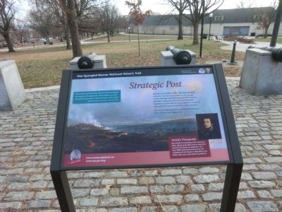
Strategic Post
Star-Spangled Banner National Historic Trail
— National Park Service, U.S. Department of the Interior —
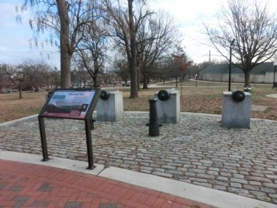
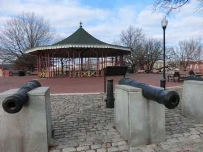
Known as Lookout Hill, this high ground served as observation post, military camp, and gun battery. Although unfinished when the British arrived, the battery helped fend off a naval flanking attack September 14, 1814. Had the enemy maneuver succeeded, they could have penetrated the city’s western defenses.
The circular battery was later named Fort Wood for an officer killed on the Niagara River.
Artist’s Viewpoint
Best known for paintings of the American West, Alfred Jacob Miller left and important record of the Battle of Baltimore. As a teen, Miller painted this scene from the viewpoint of Fort Wood in 1828-1829 as his father, who was in the battle, described it.
“The well directed fire of the little fort (Wood) checked the enemy on his approach, and probably saved the town from destruction in the dark hours of the night.”
Eyewitness account Salem Gazette, September 27, 1814.
Erected by National Park Service, U.S. Department of the Interior.
Topics and series. This historical marker is listed in this topic list: War of 1812. In addition, it is included in the Star Spangled Banner National Historic Trail series list. A significant historical date for this entry is September 14, 1814.
Location. 39° 16.284′ N, 76° 36.486′ W. Marker is in Baltimore, Maryland. It is in Riverside. Marker is on East Randall Street. The marker is located in Leone Riverside Park. Touch for map. Marker is at or near this postal address: 301 E Randall St, Baltimore MD 21230, United States of America. Touch for directions.
Other nearby markers. At least 8 other markers are within walking distance of this marker. Fort Look-Out (within shouting distance of this marker); Leone Riverside Park (about 400 feet away, measured in a direct line); Raymond R. Allen Court (approx. 0.3 miles away); Holy Cross World War II Memorial (approx. 0.4 miles away); Bethlehem Steel Whirley Crane, 1942 (approx. 0.4 miles away); Platt and Company Oyster Packers (approx. 0.4 miles away); a different marker also named Platt and Company Oyster Packers (approx. 0.4 miles away); Working Point by David Hess (approx. 0.4 miles away). Touch for a list and map of all markers in Baltimore.
Credits. This page was last revised on February 4, 2022. It was originally submitted on December 21, 2014, by Don Morfe of Baltimore, Maryland. This page has been viewed 740 times since then and 6 times this year. Photos: 1, 2, 3. submitted on December 21, 2014, by Don Morfe of Baltimore, Maryland. • Bill Pfingsten was the editor who published this page.


