Near Louisbourg in Cape Breton Region, Nova Scotia — The Atlantic Provinces (North America)
Kennelly Point
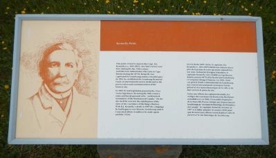
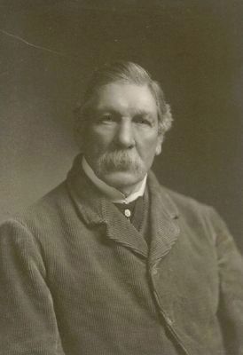
This point of land is named after Capt. D.J. Kennelly (ca. 1831-1907), who had a house near here during the late 19th century. An Irish-born industrialist who came to Cape Breton during the 1870s, Kennelly was captivated by Louisbourg and its colorful past. In 1903 he established the Louisbourg Memorial Fund, an international society dedicated to the preservation and commemoration of the historic site.
In 1906 he had legislation passed in the Nova Scotia legislature declaring the 18th-century ruins and burial grounds to be “an historical monument of the Dominion of Canada.” On the site itself he oversaw the stabilization of the ruins of the casemates of the King’s Bastion. With D.J. Kennelly’s death in 1907 the campaign he had begun to save historic Louisbourg ended. Concerted efforts would not be made again until the 1920s.
French:
Vers la fin du XIXᵉ siècle, le capitaine D.J. Kennelly (v. 1831-1907) habita une maison située près de la pointe de terre qui porte aujourd’hui son nom. Industriel d’origine irlandaise, le capitaine Kennelly vint s’établir au Cap-Breton dans les années 1870; il fut fasciné par Louisbourg et son passé d’histoire. En 1903, il mit sur pied le Fonds commémoratif de Louisbourg, une société internationale ayant pour but de préserver les ruins historique de la ville et de faire revivre le passé du site.
Grâce aux efforts du capitaine Kennelly, les vestiges de casemates du Bastion du Roi furent consolidés et, en 1906, l’Assemblée legislative de la Nouvelle-Ecosse adopta un loi proclamant Louisbourg un “monument historique de Dominion du Canada”. Le capitaine Kennelly mourut en 1907 et il fallut attendre les années 1920 pour que de nouveaux efforts soient déployés afin de préserver le site historique de Louisbourg.
Erected by Parks Canada.
Topics. This historical marker is listed in these topic lists: Charity & Public Work • Forts and Castles. A significant historical year for this entry is 1903.
Location. 45° 54.388′ N, 59° 57.411′ W. Marker is near Louisbourg, Nova Scotia, in Cape Breton Region. Marker is on Havenside Road. Touch for map. Marker is at or near this postal address: 573 Havenside Road, Louisbourg NS B1C 1P4, Canada. Touch for directions.
Other nearby markers. At least 8 other markers are within 3 kilometers of this marker, measured as the crow flies. Lighthouse Point (within shouting distance of this marker); Louisbourg Harbour (within shouting distance of this marker); First Lighthouse (about 120 meters away, measured in a direct line); French Garrison at Louisbourg (about 120 meters away); First Lighthouse Tower (about 120 meters away);
19th-Century Lighthouse (about 120 meters away); The Lobster Fishery (approx. 0.7 kilometers away); French Naval Guns (approx. 2.1 kilometers away). Touch for a list and map of all markers in Louisbourg.
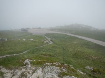
More about this marker. This marker is located near the parking lot at the end of Havenside Road.
Also see . . . The McLennans of Petersfield - Cape Breton Regional Library. This website provides an overview of the efforts in the preservation of Fortress Louisbourg. (Submitted on December 28, 2014, by Barry Swackhamer of Brentwood, California.)
Credits. This page was last revised on November 27, 2019. It was originally submitted on December 28, 2014, by Barry Swackhamer of Brentwood, California. This page has been viewed 454 times since then and 22 times this year. Last updated on November 26, 2019, by Steve Stoessel of Niskayuna, New York. Photos: 1, 2, 3. submitted on December 28, 2014, by Barry Swackhamer of Brentwood, California.


