Old Town in Alexandria, Virginia — The American South (Mid-Atlantic)
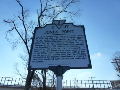
Jones Point
Erected 2002 by Department of Historic Resources. (Marker Number E-117.)
Topics and series. This historical marker is listed in these topic lists: Colonial Era • Native Americans • Settlements & Settlers • War, World I. In addition, it is included in the Virginia Department of Historic Resources (DHR) series list. A significant historical year for this entry is 1791.
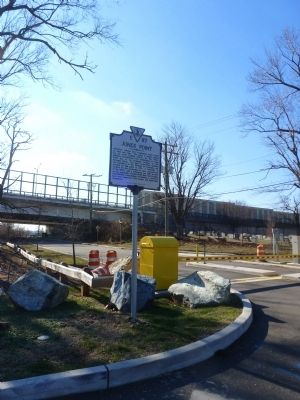
Location. 38° 47.641′ N, 77° 2.747′ W. Marker is in Alexandria, Virginia. It is in Old Town. Marker is at the intersection of South Royal Street and Jones Point Drive, on the left when traveling south on South Royal Street. Touch for map. Marker is in this post office area: Alexandria VA 22314, United States of America. Touch for directions.
Other nearby markers. At least 8 other markers are within walking distance of this marker. The Lost Village of Cameron at Great Hunting Creek (about 700 feet away, measured in a direct line); The Original Saint Mary's Church (about 800 feet away); Battery Rodgers (approx. 0.2 miles away); First Catholic Church in Virginia (approx. 0.2 miles away); In Memory of Ronald F. Kirby (approx. 0.2 miles away); Contrabands and Freedmen Cemetery Memorial (approx. 0.2 miles away); Graves Under South Washington Street (approx. 0.2 miles away); Freedmen’s Cemetery (approx. 0.2 miles away). Touch for a list and map of all markers in Alexandria.
Credits. This page was last revised on January 28, 2023. It was originally submitted on December 31, 2014, by Adam Margolis of Mission Viejo, California. This page has been viewed 971 times since then and 40 times this year. Photos: 1, 2. submitted on December 31, 2014, by Adam Margolis of Mission Viejo, California. • Bernard Fisher was the editor who published this page.

