Englishtown in Victoria County, Nova Scotia — The Atlantic Provinces (North America)
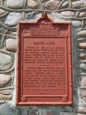
Sainte-Anné
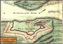
Settled, 1629, by Captain Charles Daniel, and site of an early Jesuit Mission. Selected, 1713, as a naval base and one of the principal places in Isle Royale, named Port Dauphin and strongly fortified. Its importance declined with the choice, 1719, of Louisbourg as the capital.
French:
Fondeé en 1629 par le capitaine Charles Daniel, Sainte-Anné fut l’une des premières missions Jésuites. Base navale fortifiée sous le nom de Port-Dauphin (1713) et chef-lieu de l’Ile Royale, son importance s’effaça devant Louisbourg devenue capitale en 1719.
This site donated by George Edward Fader
Erected 1930 by Historic Sites and Monument Board of Canada/Commission de lieux et monuments historique du Canada.
Topics and series. This historical marker is listed in these topic lists: Forts and Castles • Settlements & Settlers. In addition, it is included in the Acadian History series list. A significant historical year for this entry is 1629.
Location. 46° 17.233′ N, 60° 32.417′ W. Marker is in Englishtown, Nova Scotia, in Victoria County. Marker is on Nova Scotia Route 312, on the right when traveling south. Touch for map. Marker is at or near this postal address: 1160 Nova Scotia Highway 312, Englishtown NS B0C 1H0, Canada. Touch for directions.
Other nearby markers. At least 2 other markers are within 10 kilometers of this marker, measured as the crow flies. Bird Islands (approx. 0.3 kilometers away); Reverend Norman McLeod (approx. 9.7 kilometers away).
More about this marker. This marker is opposite the Englishtown Bus Cafe.br
Sainte-Anne, renamed Englishtown, is not to be confused with nearby Saint Anns.
Also see . . . Englishtown, Nova Scotia. Englishtown is one of the oldest settlements in North America, having been established as a French fishing port in 1597. In 1629, Charles Daniel constructed the first French fortification in Ile Royale with the Scottish prisoners he obtained from the raid on Baleine, Nova Scotia. (Submitted on December 31, 2014, by Barry Swackhamer of Brentwood, California.)
Credits. This page was last revised on June 16, 2016. It was originally submitted on December 31, 2014, by Barry Swackhamer of Brentwood, California. This page has been viewed 334 times since then and 5 times this year. Photos: 1, 2, 3. submitted on December 31, 2014, by Barry Swackhamer of Brentwood, California. • Andrew Ruppenstein was the editor who published this page.


