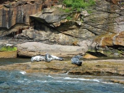
Englishtown in Victoria County, Nova Scotia — The Atlantic Provinces (North America)
Bird Islands
Inscription.
English:
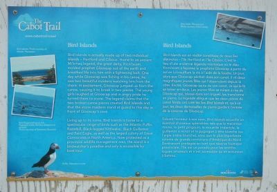
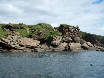
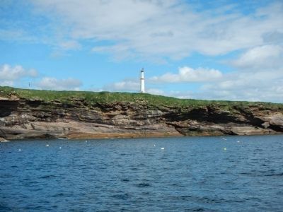
Bird Islands is actually made up of two individual islands - Hertford and Ciboux. Home to an ancient Mi’kimaq legend, the great deity, Ktchi’scam, molded prophet Glooscap out of the earth ad breathed life into him with a lightening bolt. One day while Gloosscap was fishing in his canoe, he saw two beautiful maidens watching him from the shore. In excitement, Glooscap jumped up from the canoe, causing it to break into two pieces. The young girls laughed at Glooscap and in angry pride he turned them into stone. The legend claims that the two broken canoe pieces created Bird Islands and the the stone maidens stand guard to this day in front of Glooscap’s cave.
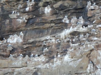
Living up to its name, Bird Islands is home to a spectacular range of birds such as the Atlantic Puffin, Razorbill, Black-legged Kittiwake, Black Guillemot and Bald Eagle, as well as the largest colony of Great Cormorants in North America. Now protected as a provincial wildlife management area, the island is a birdwatcher’s paradise and only is only accessible by boat tour.
French:
Bird Island est en réalité constituée de deux îles distinctes - I’île Hertford et L’île Ciboux, C’est le lieu d’une ancienne légende micmaque où le dieu Ktcni’scam a façonné le prophète Glooscap à partier du sol en lui insufflant la vie à l’aide de la foudre. Un jour, alors que Glooscap pêchait dans son canot, il vit deux magnifiques jeune filles qui l’observaient depuis la côte. Excité, Glooscap sauta de son canot, ce qui le fit se briser en deux. Les jeune filles se mirent à rire de Glooscap qui, blessé dans son orgueil, les transforma en pierre. Les légende allègue que les deux pièces du canot fendu ont créé les îles Bird Island et, qu'à ce jour, les deux demoiselles de pierre gardent l’entrée de la caverne de Glooscap.
Faisant honneur à son nom, Bird Island accueille un éventail d’oiseaux splendides tels que le macareux moine, le petit pingouin, la mouette tridactyle, le guillemot à miroir et le pygargue à tête blanche (ou l’aigle à tête blanche), ainsi que la plus importante colonie de grands cormorans d’Amérique du Nord. Dorénavant protégée en tant que réserve faunique provinciale, l’île est un paradise pour les ornithologues amateurs et n’est accessible qu’en excursion à bateau.
Erected by Enterprise Cape Breton Corporation & Government of Nova Scotia.
Topics. This historical marker is listed in these topic lists: Animals • Environment • Native Americans.
Location. 46° 17.391′ N, 60° 32.518′ W. Marker is in Englishtown, Nova Scotia, in Victoria County. Marker is on Nova Scotia Route 312, on the right when traveling south. Touch for map. Marker is at or near this postal address: 1207 Nova Scotia 312, Englishtown NS B0C 1H0, Canada. Touch for directions.
Other nearby markers. At least 6 other markers are within 27 kilometers of this marker, measured as the crow flies. Sainte-Anné (approx. 0.3 kilometers away); Reverend Norman McLeod (approx. 9.8 kilometers away); Alexander Graham Bell (approx. 26 kilometers away); First Flight by a British Subject in the British Empire (approx. 26 kilometers away); The First Airplane Flight in Canada (approx. 26 kilometers away); Alexander Graham Bell National Historic Park (approx. 26 kilometers away).
More about this marker. This marker is located at a kiosk near the north-end ferry dock of the Englishtown Ferry.
Credits. This page was last revised on June 12, 2020. It was originally submitted on January 2, 2015. This page has been viewed 464 times since then and 16 times this year. Last updated on June 9, 2020. Photos: 1, 2, 3, 4, 5. submitted on January 2, 2015, by Barry Swackhamer of Brentwood, California. • J. Makali Bruton was the editor who published this page.
