Charlottetown in Queens County, Prince Edward Island — The Atlantic Provinces (North America)
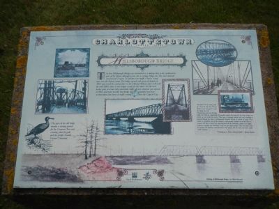
Hillsborough Bridge
Charlottetown, Prince Edward Island
”My father told me many years ago about the time the Murray Harbour train attempted to cross the bridge from the Charlottetown side and all bridge traffic was held up. Apparently the gasoline engine that opened the draw bridge was seized up and would not move. There was a schooner loaded with coal, awaiting to proceed through the draw to Falconwood Hospital Wharf to unload its cargo. They called on my father, one of the trainmen (who usually weighed in at that time at about 250 lbs.) to throw the large flywheel on the stationary engine or to apply whatever strength was necessary to get the gas engine going. Then the draw could be opened, the schooner could proceed to the wharf, and the train and other traffic could continue. - ”Growing up in Prince Edward Island” - Byron Burns
Erected by City of Charlottetown.
Topics. This historical marker is listed in this topic list: Bridges & Viaducts. A significant historical year for this entry is 1905.
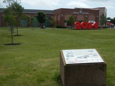
Location. 46° 14.04′ N, 63° 7.292′ W. Marker is in Charlottetown, Prince Edward Island, in Queens County. Marker is on Water Street close to Prince Street. Touch for map. Marker is at or near this postal address: 188 Water Street, Charlottetown PE C1A 0C4, Canada. Touch for directions.
Other nearby markers. At least 8 other markers are within walking distance of this marker. Threaded Together with Iron and Steel (within shouting distance of this marker); Railway Car Shop (within shouting distance of this marker); Railway Brass Shop (within shouting distance of this marker); The Hillsborough River (about 180 meters away, measured in a direct line); Great George Street Historic District (about 180 meters away); The Gainsford House (about 210 meters away); William Henry Pope (1825 – 1879) (about 210 meters away); Heralded Arrival… of the Circus (about 210 meters away). Touch for a list and map of all markers in Charlottetown.
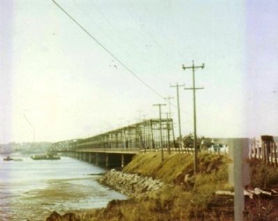
Also see . . . Hillsborough River Bridge - Wikipedia. The Hillsborough River is a 30 km long and up to 1 km wide tidal inlet which empties into Charlottetown Harbour. During the 1800s, a seasonal passenger ferry service operated between the Charlottetown waterfront and Ferry Point on the opposite side. When the river was frozen in winter, horse-drawn sleighs would cross the ice. In 1905, the Prince Edward Island Railway (PEIR) constructed a railway bridge across the river, allowing for train travel to the eastern side. (Submitted on January 8, 2015, by Barry Swackhamer of Brentwood, California.)
Credits. This page was last revised on June 16, 2016. It was originally submitted on January 8, 2015, by Barry Swackhamer of Brentwood, California. This page has been viewed 456 times since then and 24 times this year. Photos: 1, 2, 3. submitted on January 8, 2015, by Barry Swackhamer of Brentwood, California. • Andrew Ruppenstein was the editor who published this page.


