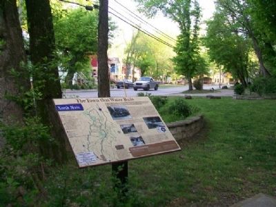
The Town that Water Built
North Main
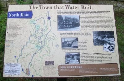
First by horseback, wagons or on foot, invalids from all over this region flocked to Eureka Springs in 1879 to seek cures from the miraculous healing springs. But soon there were easier ways to arrive - stagecoaches, then trains. This laid a base for an early "industrial park."
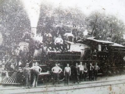
Bringing railroad service through the rugged mountains and across the White River was no easy feat. A passage was blasted out of a cliff near Beaver, north of town, a high trestle bridge erected over the river, track laid over smaller creeks and rail bed cut out of bluffs along Leatherwood Creek. The cost was $200,000, very expensive in 1882!
"The invalid or tourist who has traveled from the East or North, can leave St. Louis at night and arrive at the Springs the next day... The Kansas City, Springfield & Memphis Railroad run Pullman Parlor Sleeping Cars and chair cars the entire length of their line. All trains reach the city in daylight, and at the depot transfer omnibuses and carriages are in waiting to convey visitors to any hotel or private residence in the city." W.W. Johnston, M.D., The Eureka Springs Arkansas, 1885
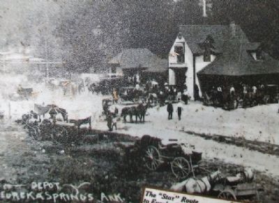
The first Eureka Springs Railway Depot was built in 1882. It was used until 1914 when the current limestone depot was constructed. As part of the extensive Frisco Line, Eureka Springs was finally
connected to the rest of the country!Built in 1891 as the city's electric power supply, the Power House had huge coal-fired boilers to run the generators. An ice factory was added later. By 1908 it produced 4 tons of ice daily with 6400 sq. ft. of cold storage.
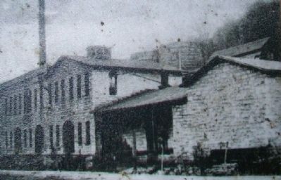
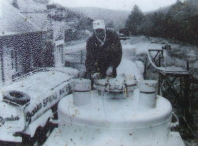
Almost as soon as the town began, Eureka Springs bottled and shipped water from the famous springs. The most enduring company was the Eureka Springs Water Company with their trade name Ozarka. As early as 1904, four train tanks of Ozarka Water from nearby springs were shipped out each week. Rail shipping continued until the 1950s. At one time the Ozarka Water plant used all these large buildings.
In the Neighborhood
The Round House: Built as the early gas works using limestone quarried north of town.
North Main Arts District: A number of studios, galleries and restaurants make North Main Street a pleasant stroll combining art with the natural beauty of the hills and bluffs rising over both sides.
Eureka Springs & North Arkansas Railway: A scenic, short-line passenger train offers a trip on part of the original route. Visit the second depot, built in 1913, and the train yards.
Landmarks [Map and Key]
This material is based upon work assisted by a grant from the U.S. Department of the Interior, National Park Service, a Preserve America grant. Any opinions, findings, and conclusions or recommendations expressed in this material are those of the author and do not necessarily reflect the views of the Department of the Interior. Photographs courtesy of the Cornerstone Bank of Eureka Springs, Eureka Springs Historical Museum and the Eureka Springs Carnegie Public Library.
Erected by Eureka Springs Downtown Network.
Topics. This historical marker is listed in these topic lists: Environment • Industry & Commerce • Railroads & Streetcars • Settlements & Settlers. A significant historical year for this entry is 1879.
Location. 36° 24.687′ N, 93° 44.038′ W. Marker is in Eureka Springs, Arkansas, in Carroll County. Marker is on Main Street (State Highway 23) 0.1 miles north of Magnetic Drive, on the left when traveling north. Marker is at a roadside rest/parking area. Touch for map. Marker is in this post office area: Eureka Springs AR 72632, United States of America. Touch for directions.
Other nearby markers. At least 8 other markers are within walking distance of this marker. The Star of Gladness (about 400 feet away, measured in a direct line); The Brownstone Inn (about 500 feet away); The Round House (about 600 feet away); Bridgeford House (about 600 feet away); Steam Locomotive (about 800 feet away); The Railroad Depot (approx. 0.2 miles away);
Also see . . .
1. Eureka Springs History. (Submitted on January 9, 2015, by William Fischer, Jr. of Scranton, Pennsylvania.)
2. The Historic Springs of Eureka Springs, Arkansas. (Submitted on January 9, 2015, by William Fischer, Jr. of Scranton, Pennsylvania.)
3. Eureka Springs & North Arkansas Railway. (Submitted on January 9, 2015, by William Fischer, Jr. of Scranton, Pennsylvania.)
Credits. This page was last revised on September 3, 2020. It was originally submitted on January 9, 2015, by William Fischer, Jr. of Scranton, Pennsylvania. This page has been viewed 507 times since then and 39 times this year. Photos: 1, 2, 3, 4, 5, 6, 7. submitted on January 9, 2015, by William Fischer, Jr. of Scranton, Pennsylvania.
