Florence in Lauderdale County, Alabama — The American South (East South Central)
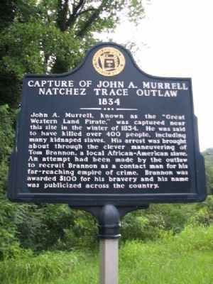
Capture of John A. Murrell
Natchez Trace Outlaw
— 1834 —
Erected by Florence Historical Board Florence Alabama.
Topics. This historical marker is listed in this topic list: African Americans. A significant historical year for this entry is 1834.
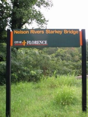
Location. 34° 48.452′ N, 87° 42.019′ W. Marker is in Florence, Alabama, in Lauderdale County. Marker is on Waterloo Road, 0.1 miles east of Cypress Bend Dr.. Located on Waterloo Road on left side of road at Nelson Rivers Starkey Bridge. Touch for map. Marker is in this post office area: Florence AL 35630, United States of America. Touch for directions.
Other nearby markers. At least 8 other markers are within 2 miles of this marker, measured as the crow flies. Pesthouse and Cemetery / Pestilences (approx. 0.2 miles away); The Greater Mount Moriah Primitive Baptist Church (approx. ¾ mile away); Ante-Bellum Cotton Mills 1840 (approx. 0.8 miles away); Birthplace of W.C. Handy (approx. 0.9 miles away); The University of North Alabama (approx. one mile away); Gilbert Elementary School (approx. 1.1 miles away); College Place Historic District (approx. 1.1 miles away); World War I Memorial Trees (approx. 1.2 miles away). Touch for a list and map of all markers in Florence.
Also see . . .
1. William Gilmore Simms and the American Frontier by John Caldwell guides, Caroline Collins. John A. Murrell and the Imaginations of Simms and Faulkner (Submitted on March 10, 2010, by Sandra Hughes Tidwell of Killen, Alabama, USA.)
2. John Murrel (Bandit). (Submitted on March 10, 2010, by Sandra Hughes Tidwell of Killen, Alabama, USA.)
Credits. This page was last revised on August 28, 2020. It was originally submitted on March 10, 2010. This page has been viewed 2,568 times since then and 111 times this year. Last updated on August 8, 2020, by Duane and Tracy Marsteller of Murfreesboro, Tennessee. Photos: 1, 2. submitted on March 10, 2010, by Sandra Hughes Tidwell of Killen, Alabama, USA. • J. Makali Bruton was the editor who published this page.
Editor’s want-list for this marker. A wide shot of the marker and its surroundings. • Can you help?

