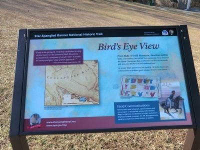
Birdís Eye View
Star-Spangled Banner National Historic Trail
ó War of 1812 ó
As enemy ships approached on April 28, 1813, the Americans relayed news to military posts situated from here to Elkton.
“Early in the spring (of 1813) they established a camp of observation on the summit of Bulls Mountain, and stationed a company of cavalry there to watch the enemy and give notice of their approach..."
History of Cecil County, George Johnston, 1881
Field Communications
Before radio and telegraph, signal systems and messengers on horseback relayed information. Flags in daytime and lanterns at night sometimes displayed coded messages. On Elk Neck peninsula, cavalry carried news from station to station.
[Inscription next to the image on the right]
A page from Commodore John Rodgerís signal book. Image/Courtesy Mystic Seaport, Denison-Rodgers Collection
[In lower right corner]
Image (c) Gerry Embleton
[In lower left]
Map of the Upper Bay by C P. Hauducoeur, 1799
Image / Courtesy Enoch Pratt Free Library, Central Library / State Library Resource Center, Baltimore
Erected by National Park
Topics and series. This historical marker is listed in this topic list: War of 1812. In addition, it is included in the Star Spangled Banner National Historic Trail series list. A significant historical date for this entry is April 28, 1813.
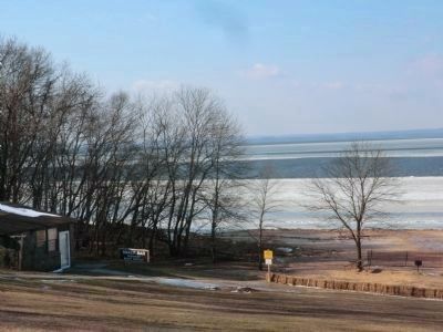
Location. 39° 29.586′ N, 75° 59.298′ W. Marker is in North East, Maryland, in Cecil County. Marker is on North East Beach Road, on the left when traveling west. The marker is located in Elk Neck State Park. Touch for map. Marker is in this post office area: North East MD 21901, United States of America. Touch for directions.
Other nearby markers. At least 8 other markers are within 6 miles of this marker, measured as the crow flies. An Earthly Paradise (within shouting distance of this marker); Overlook of General Howeís Landing (approx. 2.3 miles away); Sentinel on the Bay (approx. 2Ĺ miles away); Why Build a Lighthouse? (approx. 2Ĺ miles away); Welcome to Turkey Point! (approx. 3.2 miles away); The Enemy Returns (approx. 3.2 miles away); Cherry Grove (approx. 4 miles away); The Perryville Mule School (approx. 5.2 miles away). Touch for a list and map of all markers in North East.
More about this marker. The text includes "Rodger's" where "Rodgers'" is expected.
Credits. This page was last revised on July 1, 2020. It was originally submitted on January 18, 2015, by Don Morfe of Baltimore, Maryland. This page has been viewed 550 times since then and 22 times this year. Last updated on July 1, 2020, by Carl Gordon Moore Jr. of North East, Maryland. Photos: 1, 2, 3. submitted on January 18, 2015, by Don Morfe of Baltimore, Maryland. • Bill Pfingsten was the editor who published this page.


