Cedarburg in Ozaukee County, Wisconsin — The American Midwest (Great Lakes)
Interurban Bridge / Riding the Interurban
Inscription.
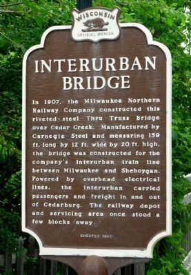
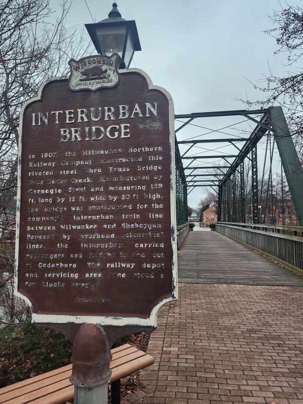
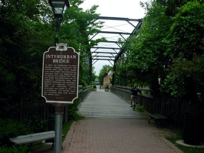
Interurban Bridge
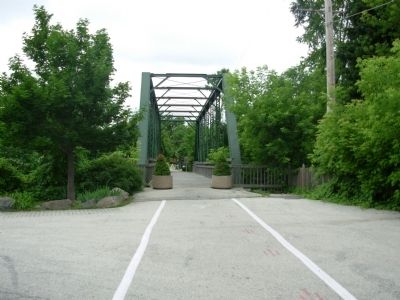
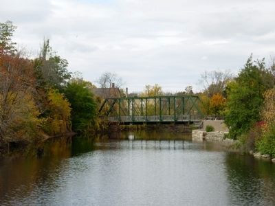
In 1907, the Milwaukee Northern Railway Company constructed this riveted-steel Thru Truss Bridge over Cedar Creek. Manufactured by Carnegie Steel and measuring 159 ft. long by 12 ft. wide by 20 ft. high, the bridge was constructed for the company’s interurban train line between Milwaukee and Sheboygan. Powered by overhead electrical lines, the interurban carried passengers and freight in and out of Cedarburg. The railway depot and servicing area once stood a few blocks away.
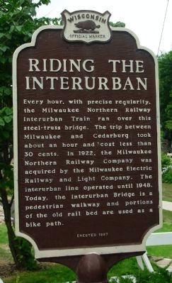
Riding the Interurban
Every hour, with precise regularity, the Milwaukee Northern Railway Interurban Train ran over this steel-truss bridge. The trip between Milwaukee and Cedarburg took about an hour and cost less than 30 cents. In 1922, the Milwaukee Northern Railway Company was acquired by the Milwaukee Electric Railway and Light Company. The interurban line operated until 1948. Today, the Interurban Bridge is a pedestrian walkway and portions of the old rail bed are used as a bike path.
Erected 1997 by State Historical Society of Wisconsin. (Marker Number 360.)
Topics and series. This historical marker is listed in these topic lists: Bridges & Viaducts • Railroads & Streetcars . In addition, it is included in the Wisconsin Historical Society series list. A significant historical year for this entry is 1907.
Location. 43° 17.92′ N, 87° 59.269′ W. Marker is in Cedarburg, Wisconsin, in Ozaukee County. Marker is on Washington Ave., on the right when traveling north. Marker is on Ozaukee Interurban Trail. Touch for map. Marker is at or near this postal address: W62 N646 Washington Ave, Cedarburg WI 53012, United States of America. Touch for directions.
Other nearby markers. At least 8 other markers are within walking distance of this marker. Liberty Tree Memorial (here, next to this marker); Historic Cedarburg (within shouting distance of this marker); The First 100 Years (about 600 feet away, measured in a direct line); Origin of Cedar Creek / Mills on the Creek (about 700 feet away); Cedarburg Mill (about 800 feet away); The History of the Boerner Building (approx. 0.2 miles away); Cedarburg Woolen Mill (approx. 0.2 miles away); Cedarburg Cultural Center Building (approx. ¼ mile away). Touch for a list and map of all markers in Cedarburg.
Related markers. Click here for a list of markers that are related to this marker. All relate to TMER&L (The Milwaukee Electric Railway & Light Co.)
Also see . . . Interurban Trail. Website homepage (Submitted on November 25, 2010.)
Credits. This page was last revised on December 25, 2023. It was originally submitted on May 25, 2010, by Paul Fehrenbach of Germantown, Wisconsin. This page has been viewed 1,200 times since then and 58 times this year. Last updated on January 29, 2015, by Paul Fehrenbach of Germantown, Wisconsin. Photos: 1, 2. submitted on May 25, 2010, by Paul Fehrenbach of Germantown, Wisconsin. 3. submitted on December 18, 2023, by Greta Schassler of Milwaukee, Wisconsin. 4, 5. submitted on May 25, 2010, by Paul Fehrenbach of Germantown, Wisconsin. 6. submitted on October 19, 2010, by Paul Fehrenbach of Germantown, Wisconsin. • Bill Pfingsten was the editor who published this page.
