Marker Logo HMdb.org THE HISTORICAL
MARKER DATABASE
“Bite-Size Bits of Local, National, and Global History”
Earleville in Cecil County, Maryland — The American Northeast (Mid-Atlantic)
 

Mount Harmon Plantation at World's End


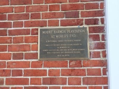
Mount Harmon Plantation at World's End Marker image. Click for full size.
Photographed By Don Morfe, January 30, 2015
1. Mount Harmon Plantation at World's End Marker
Inscription. Mount Harmon Plantation at World's End. A National Trust Historic House. The gift of Mrs. Harry Clark Boden IV in memory of James Louttit Sr. and his wife, Mary George who acquired the property in 1760
 
Erected 1974.
 
Topics. This historical marker is listed in these topic lists: Colonial EraSettlements & Settlers. A significant historical year for this entry is 1760.
 
Location. 39° 22.914′ N, 75° 56.214′ W. Marker is in Earleville, Maryland, in Cecil County. Marker is on Mount Harmon Road, on the left when traveling south. As you approach the mansion by road going south, the road will split, with one fork passing by each side of the mansion. Take the right fork for the marker to be on your left. Touch for map. Marker is in this post office area: Earleville MD 21919, United States of America. Touch for directions.
 
Other nearby markers. At least 8 other markers are within walking distance of this marker. Tobacco and Mount Harmon (within shouting distance of this marker); a different marker also named Mount Harmon Plantation at World’s End (within shouting distance of this marker); Plantation Life in the Colonial Era (within shouting distance of this marker); a different marker also named Mount Harmon Plantation at World's End (approx. 0.2 miles away); The Sassafras River (approx. 0.2 miles away);
Paid Advertisement
Click on the ad for more information.
Please report objectionable advertising to the Editor.
Click or scan to see
this page online
History Quest (approx. 0.2 miles away); On the Wild Side (approx. 0.2 miles away); Hilltop View (approx. ¼ mile away). Touch for a list and map of all markers in Earleville.
 
Mount Harmon Plantation at World's End Marker image. Click for full size.
Photographed By Bill Coughlin, October 12, 2019
2. Mount Harmon Plantation at World's End Marker
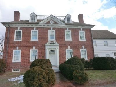
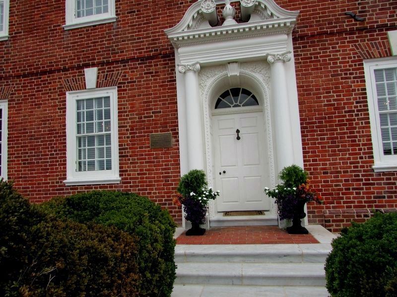
Mount Harmon Plantation-Front of Residence image. Click for full size.
Photographed By Don Morfe, January 30, 2015
3. Mount Harmon Plantation-Front of Residence
Note: Plaque is mounted to the left of the front door.
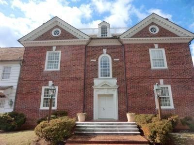
Mount Harmon Plantation-Back of Residence image. Click for full size.
Photographed By Don Morfe, January 30, 2015
4. Mount Harmon Plantation-Back of Residence
Mount Harmon Plantation-Gardens located in the back of the Residence image. Click for full size.
Photographed By Don Morfe, January 30, 2015
5. Mount Harmon Plantation-Gardens located in the back of the Residence
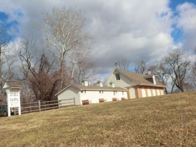
Mount Harmon Plantation-Horse stables image. Click for full size.
Photographed By Don Morfe, January 30, 2015
6. Mount Harmon Plantation-Horse stables
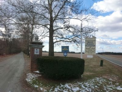
Mount Harmon Plantation-signs at the entrance image. Click for full size.
Photographed By Don Morfe, January 30, 2015
7. Mount Harmon Plantation-signs at the entrance
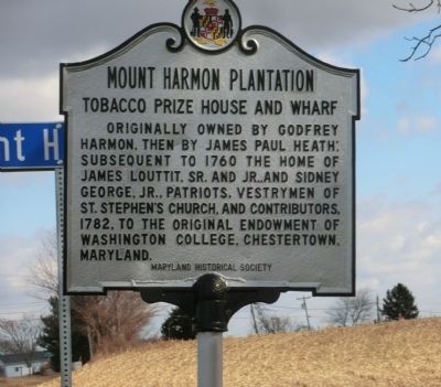
Mount Harmon Plantation-State of Maryland Historical Marker image. Click for full size.
Photographed By Don Morfe, January 30, 2015
8. Mount Harmon Plantation-State of Maryland Historical Marker
This marker is located near the entrance to the Plantation.
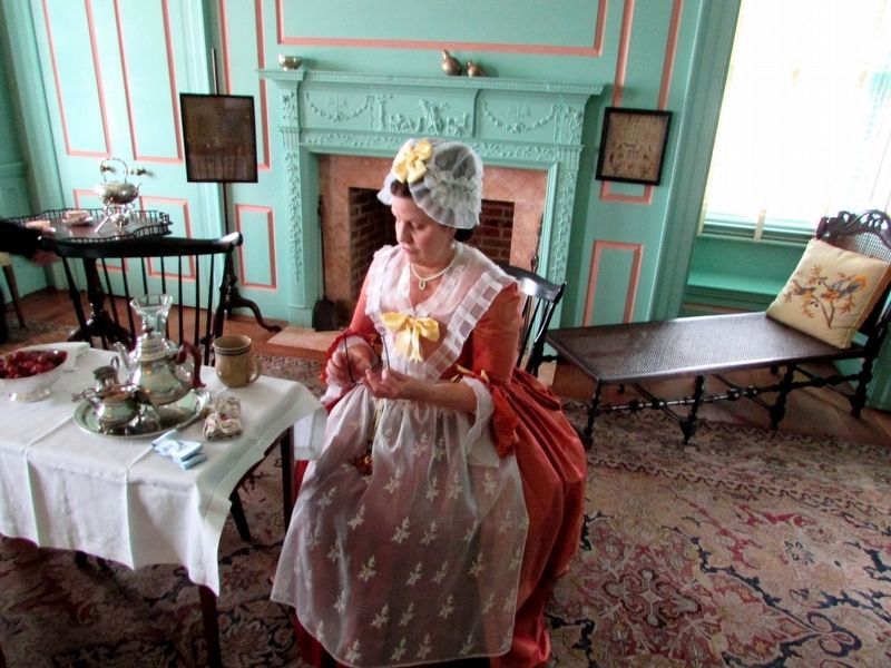
Inside the Mount Harmon Plantation Mansion image. Click for full size.
Photographed By Bill Coughlin, October 12, 2019
9. Inside the Mount Harmon Plantation Mansion
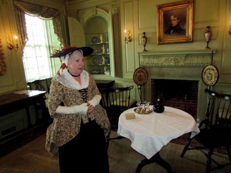
Inside the Mount Harmon Plantation Mansion image. Click for full size.
Photographed By Bill Coughlin, October 12, 2019
10. Inside the Mount Harmon Plantation Mansion
 
 
Credits. This page was last revised on September 21, 2020. It was originally submitted on February 3, 2015. This page has been viewed 731 times since then and 45 times this year. Last updated on September 21, 2020, by Carl Gordon Moore Jr. of North East, Maryland. Photos:   1. submitted on February 3, 2015, by Don Morfe of Baltimore, Maryland.   2. submitted on October 13, 2019, by Bill Coughlin of Woodland Park, New Jersey.   3, 4, 5, 6, 7, 8. submitted on February 3, 2015, by Don Morfe of Baltimore, Maryland.   9, 10. submitted on October 13, 2019, by Bill Coughlin of Woodland Park, New Jersey. • J. Makali Bruton was the editor who published this page.
Share this page.  
Share on Tumblr
m=156566

CeraNet Cloud Computing sponsors the Historical Marker Database.
This website earns income from purchases you make after using our links to Amazon.com. We appreciate your support.
Paid Advertisement
Apr. 24, 2024