Ansonborough in Charleston in Charleston County, South Carolina — The American South (South Atlantic)
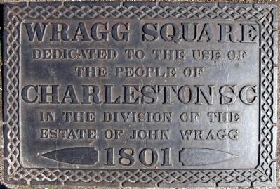
Wragg Square
in front of the Second Presbyterian Church
Dedicated To the Use Of
The People Of
Charleston SC
In The Division Of The
Estate Of John Wragg
1801
Topics. This historical marker is listed in this topic list: Charity & Public Work. A significant historical year for this entry is 1801.
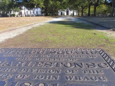
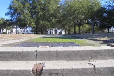
Location. 32° 47.295′ N, 79° 56.096′ W. Marker is in Charleston, South Carolina, in Charleston County. It is in Ansonborough. Marker can be reached from Meeting Street, on the left when traveling south. This marker lays flat on the ground at the top of the steps from Meeting Street. It is at the entrance to the park. Wragg Square is very close to the Joseph Manigault House. It contains a sidewalk that leads directly to the Second Presbyterian Church. Touch for map. Marker is at or near this postal address: 341 Meeting Street, Charleston SC 29401, United States of America. Touch for directions.
Other nearby markers. At least 8 other markers are within walking distance of this marker. Federal Building (a few steps from this marker); The Joseph Manigault House (within shouting distance of this marker); Wade Hampton Monument (about 300 feet away, measured in a direct line); The Charleston Museum's Joseph Manigault House (about 300 feet away); The Civil War Submarine, H.L. Hunley (about 400 feet away); The 1780 Siege of Charleston (about 500 feet away); At the Center of the Siege (about 500 feet away); Dates of Historical Interest (about 500 feet away). Touch for a list and map of all markers in Charleston.
Additional keywords. PARK
Credits. This page was last revised on February 16, 2023. It was originally submitted on February 6, 2015, by Cathi Lee of Moncks Corner, South Carolina. This page has been viewed 1,418 times since then and 122 times this year. Photos: 1, 2, 3. submitted on February 6, 2015, by Cathi Lee of Moncks Corner, South Carolina. • Bill Pfingsten was the editor who published this page.


