Vieux-Québec-Cap-Blanc-colline Parlementaire in Communauté-Urbaine-de-Québec, — Central Canada (French-Canadian)
The Grande Allée Drill Hall
Le manège de la Grande Allée
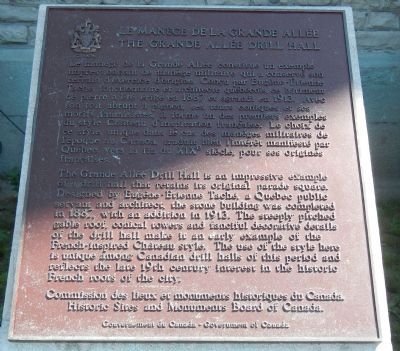
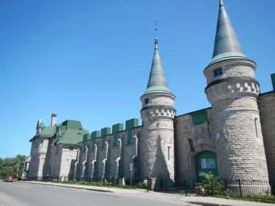
The Grande-Allée Drill Hall is an impressive example of a drill hall that retains its original parade square. Designed by Eugène-Étienne Taché, a Quebec public servant and architect, the stone building was completed in 1887, with an addition in 1913. The steeply pitched gable roof, conical towers and fanciful decorative details of the drill hall make it an early example of the French-inspired Chateau style. The use of the style here is unique among Canadian drill halls of this period and reflects the late 19th century interest in the historic French roots of the city.
French:
Le manège de la Grande-Allée constitue un exemple impressionnant d'un manège militaire qui a conservé son terrain d'exercice d'origine. Conçu par Eugène-Étienne Taché, fonctionnaire et architecte québécois, ce bâtiment de pierre a été achevé en 1887 et agrandi en 1913. Avec son toit abrupt à pignon, ses tours coniques et ses motifs fantaisistes, il forme un des premiers exemples du style Château d'inspiration française. Le choix de ce style, unique dans le cas des manèges militaires de l'époque au Canada, traduit bien l'intérêt manifesté vers la fin du XIXe siècle envers les racines françaises de la ville.
Erected by Historic Sites and Monument Board of Canada/Commission de lieux et monuments historique du Canada.
Topics and series. This historical marker is listed in this topic list: Forts and Castles. In addition, it is included in the Canada, Historic Sites and Monuments Board series list. A significant historical year for this entry is 1887.
Location. 46° 48.387′ N, 71° 12.842′ W. Marker is in Québec, in Communauté-Urbaine-de-Québec. It is in Vieux-Québec-Cap-Blanc-colline Parlementaire. Marker is on Avenue Wilfrid-Laurier close to Place George V Ouest, on the right when traveling east. Touch for map. Marker is at or near this postal address: 805 Avenue Wilfrid-Laurier, Québec G1R 2L3, Canada. Touch for directions.
Other nearby markers. At least 8 other markers are within walking distance of this marker. Adélard Godbout (about 180 meters away, measured in a direct line); In Memory of Our Fallen Soldiers (approx. 0.3 kilometers away); Le Siège de Québec, 1759 / The Siege of Québec, 1759 (approx. 0.3 kilometers away); Frontenac (approx. 0.3 kilometers away); General Montgomery’s Army (approx. 0.4 kilometers away); A Golf Club on the Plains of Abraham (approx. 0.4 kilometers away); Fortifications de / of Québec (approx. 0.4 kilometers away); Do You Know Joan of Arc? (approx. 0.4 kilometers away). Touch for a list and map of all markers in Québec.
Credits. This page was last revised on February 9, 2023. It was originally submitted on February 10, 2015, by Barry Swackhamer of Brentwood, California. This page has been viewed 363 times since then and 23 times this year. Photos: 1, 2. submitted on February 10, 2015, by Barry Swackhamer of Brentwood, California. • Andrew Ruppenstein was the editor who published this page.

