Haute-Ville in Québec in Communauté-Urbaine-de-Québec, — Central Canada (French-Canadian)
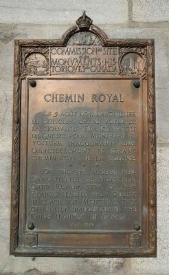
Chemin Royal
On the 5th August, 1734, Lanouillier de Boiscler, Chief Roadmaster of New France, started from Quebec by coach for Montreal thus officially inaugurating the King's Highway in Canada.
French:
Le 5 août 1734, Lanouillier de Boiscler, grand voyer de la Nouvelle-France, partit de Québec pour Montréal en voiture, inaugurant ainsi officiellement le grand chemin royal de la colonie.
Erected 1941 by Historic Sites and Monument Board of Canada/Commission de lieux et monuments historique du Canada.
Topics and series. This historical marker is listed in this topic list: Roads & Vehicles. In addition, it is included in the Canada, Historic Sites and Monuments Board series list. A significant historical year for this entry is 1734.
Location. 46° 48.767′ N, 71° 12.788′ W. Marker is in Québec, in Communauté-Urbaine-de-Québec. It is in Haute-Ville. Marker is on Rue Saint-Jean close to Côte de l'Escarpe, on the left when traveling east. Touch for map. Marker is at or near this postal address: 962 Rue Saint-Jean, Québec G1R 5C2, Canada. Touch for directions.
Other nearby markers. At least 8 other markers are within walking distance of this marker. The Artillery Park (within shouting distance of this marker); Michel Boisvert, SJ (about 120 meters away, measured in a direct line); Artillery Park: The Barracks Sector (about 150 meters away); Protecting the Upper Town (about 180 meters away); Felix-Gabreil Marchand (about 210 meters away); The Literary and Historical Society of Quebec (about 210 meters away); Le Vielle Prison de Québec (about 210 meters away); Irish Roots in Old Québec (about 210 meters away). Touch for a list and map of all markers in Québec.
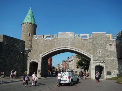
More about this marker. The marker is located at Saint-Jean (Saint John's) Gate on the outside wall of Old Québec and on the north (left) side.
Credits. This page was last revised on February 9, 2023. It was originally submitted on February 11, 2015, by Barry Swackhamer of Brentwood, California. This page has been viewed 376 times since then and 40 times this year. Photos: 1, 2. submitted on February 11, 2015, by Barry Swackhamer of Brentwood, California. • Andrew Ruppenstein was the editor who published this page.

