Near Manhattan in Riley County, Kansas — The American Midwest (Upper Plains)
Geology at Konza
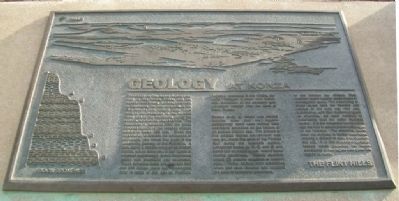
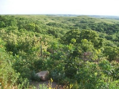
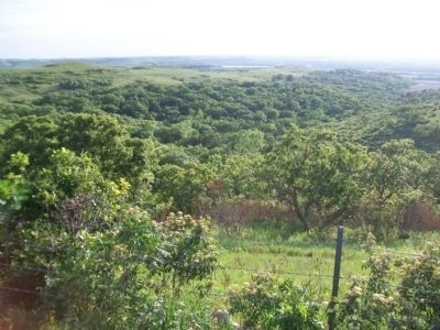
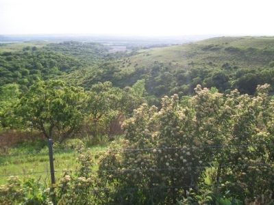
The image on this plaque depicts your view of the Konza Prairie and the Kansas River Valley. Looking from west to southwest, the view is typical of the Flint Hills in their natural state. Due west is the floodplain of the Kansas River and to the southwest, along the horizon, are two low rounded hills. The difference in elevation from the grass covered hilltops to the wooded stream valleys is about 400 feet. Given the opportunity to explore the landscape of the image, you would find clues to the underlying geology of the Flint Hills. A hike, along a stream valley or an eroded hillside, would allow you to see layers of exposed sedimentary rocks: limestones (some with chert/flint) and mudrocks. These exposed rocks are between 240 and 290 million years old. Geologists refer to rocks of this age as Permian. Originally described in the 1800s, the name "Permian" is taken from similar rock formations of the southern Ural Mountains located near the town of Perm, Russia.
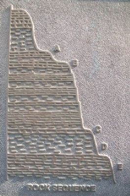
Careful study of fossils and related features show that the region's sedimentary rocks were formed from sediments deposited on the bottom of an ancient shallow sea. The climate of this ancient marine environment was very dry, much like parts of the Persian Gulf during the twentieth century. Limestone layers (A, B, C, and E) and some thin mudrock layers record these marine conditions. Thicker mudrock layers (D) provide evidence of ancient soils. These ancient soils developed when sea level lowered and exposed the area to terrestrial processes in the present day climate, thick mudrock layers weathered (decompose or disintegrate) easily. The weathering of these layers form the hillsides and valleys of the view you now see. Limestones, with their numerous layers of chert/flint, are more resistant to weathering than the softer mudrock layers. It is the limestone layers which cap the hills or create prominent ledges in the hillsides. The chert/flint, found near the surface, is harder than steel, making it difficult to plow and cultivate the soil. It is this distinctive geologic feature which preserves the native conditions of the region and gives the region its name: THE FLINT HILLS.
Erected 1997 by The Nature Conservancy and the Kansas State University Division of Biology.
Topics. This historical marker is listed in these topic lists: Environment • Paleontology.
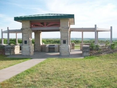
Location. 39° 7.95′ N, 96° 32.347′ W. Marker is near Manhattan, Kansas, in Riley County. Marker is on Pillsbury Drive (State Highway 177) 5 miles north of Interstate 70, on the left when traveling north. Marker is at the Konza Prairie-Kansas River Valley Interpretive Center. Touch for map. Marker is at or near this postal address: 3700 Pillsbury Drive, Manhattan KS 66502, United States of America. Touch for directions.
Other nearby markers. At least 8 other markers are within 4 miles of this marker, measured as the crow flies. Konza Prairie (here, next to this marker); The Tallgrass Prairie (about 300 feet away, measured in a direct line); Manhattan's Union Pacific Depot - Revived (approx. 3.2 miles away); Yuma Street (approx. 3.2 miles away); Change & Growth (approx. 3.2 miles away); Colorado Street (approx. 3.3 miles away); The American Veteran (approx. 3˝ miles away); Riley County Courthouse (approx. 3˝ miles away). Touch for a list and map of all markers in Manhattan.
Also see . . .
1. Konza Prairie. Kansas State University website entry (Submitted on February 13, 2015, by William Fischer, Jr. of Scranton, Pennsylvania.)
2. K-177 Overlook Park. Riley County website entry (Submitted on February 13, 2015, by William Fischer, Jr. of Scranton, Pennsylvania.)
3. Flint Hills. GeoKansas website entry (Submitted on February 1, 2022, by Larry Gertner of New York, New York.)
4. Geology in the Flint Hills. NPS Tallgrass Prairie National Preserve website entry (Submitted on February 1, 2022, by Larry Gertner of New York, New York.)
Credits. This page was last revised on February 1, 2022. It was originally submitted on February 13, 2015, by William Fischer, Jr. of Scranton, Pennsylvania. This page has been viewed 530 times since then and 23 times this year. Photos: 1, 2, 3, 4, 5, 6. submitted on February 13, 2015, by William Fischer, Jr. of Scranton, Pennsylvania.
