Near Fort Washington in Prince George's County, Maryland — The American Northeast (Mid-Atlantic)
Firepower on the Potomac
Fort Washington Park
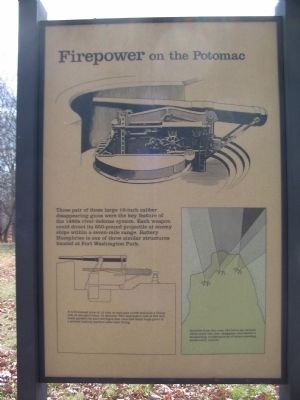
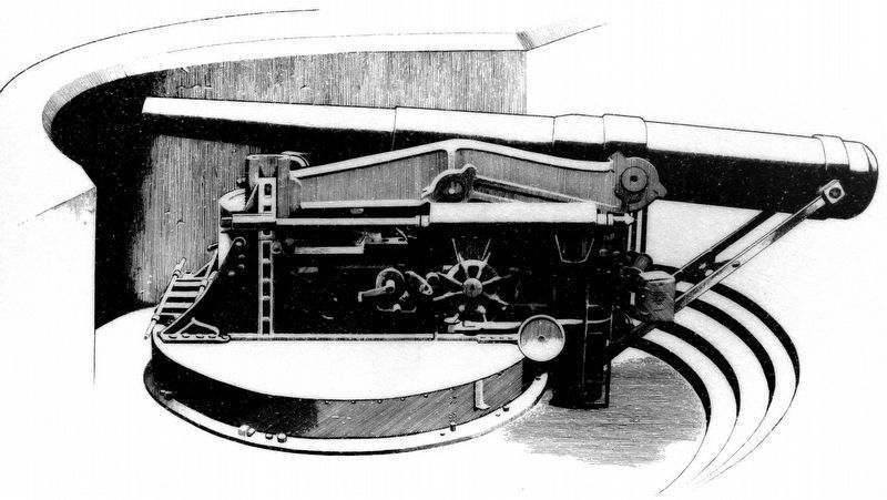
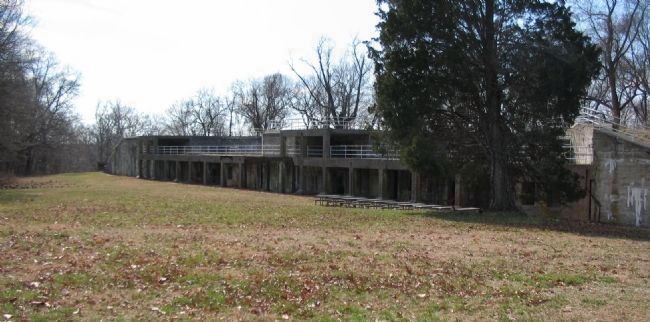
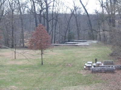
Three pair of these large 10-inch caliber disappearing guns were the key feature of the 1890s river defense system. Each weapon could direct its 650-pound projectile at enemy ships within a seven-mile range. Battery Humphries is one of three similar structures located at Fort Washington Park.
(Right Panel):
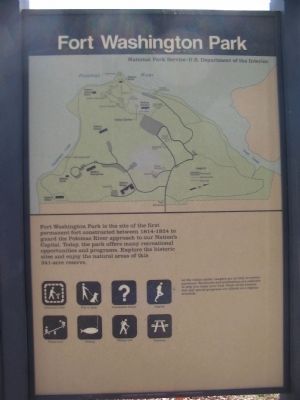
Fort Washington is the site of the first permanent fort constructed between 1814-1824 to guard the Potomac River approach to our Nation's Capital. Today, the park offers many recreational opportunities and programs. Explore the historic sites and enjoy the natural areas of this 341-acre reserve.
At the visitor center, rangers are on duty to answer questions. Brochures and publications are available to help you enjoy your visit. Tours of the historic fort and special programs are offered on a regular schedule.
Erected by Fort Washington Park - National Park Service - U.S. Department of the Interior.
Topics. This historical marker is listed in these topic lists: Forts and Castles • Military.
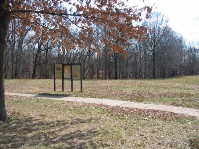
Location. 38° 42.484′ N, 77° 1.713′ W. Marker is near Fort Washington, Maryland, in Prince George's County. Marker can be reached from Fort Washington Road, on the right when traveling south. Located in Fort Washington Park, near the parking lot for Battery Humphries. Touch for map. Marker is at or near this postal address: 13551 Fort Washington Road, Fort Washington MD 20744, United States of America. Touch for directions.
Other nearby markers. At least 8 other markers are within walking distance of this marker. The Mortar Battery (approx. 0.2 miles away); Capital Guardian (approx. 0.4 miles away); a different marker also named Capital Guardian (approx. 0.4 miles away); a different marker also named Capital Guardian (approx. 0.4 miles away); Caponiere (approx. 0.4 miles away); The Northwest Demi-Bastion (approx. 0.4 miles away); Fort Washington Park (approx. 0.4 miles away); Main Gateway (approx. 0.4 miles away). Touch for a list and map of all markers in Fort Washington.
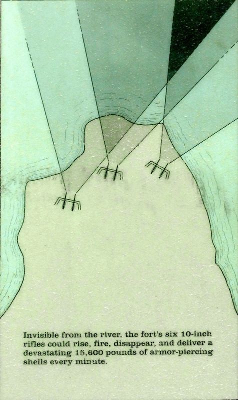
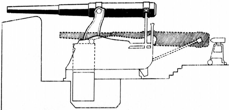
More about this marker. At the top of the left side of the marker is a depiction of a 10-inch gun in retracted position at one of the batteries. A line diagram of the gun and carriage below the text is captioned, A well-trained crew of 12 men at each gun could maintain a firing rate of one shell every 15 seconds. This impressive rate of fire was made possible by gun carriages that returned these huge guns to a precise loading position after each firing. Beside that diagram a general map of the Fort Washington area shows the location of the 10-inch batteries, Invisible from the river, the fort's six 10-inch rifles could rise, fire, disappear, and deliver a devastating 15,600 pounds of armor-piercing shells every minute.
The right side panel displays a park map showing the road and trail network. The locations of Batteries Willdn, Smith, Meigs, Humphries, Emory, Decatur, White, and James Many are indicated.
Also see . . . Fort Washington. National Park Service page. (Submitted on June 1, 2008, by Craig Swain of Leesburg, Virginia.)
Photographed By Allen C. Browne, April 14, 2019
5. 10-Inch Disappearing Gun
A well-trained crew of 12 men at each gun could maintain a firing rate of one shell every 15 seconds. This impressive rate of fire was made possible by gun carriages that returned these huge guns to a precise loading position after each firing.Close-up of image on marker
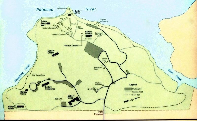
7. Fort Washington Park
National Park Service
U.S. Department of The Interior
National Park Service
U.S. Department of The Interior
Fort Washington is the site of the first permanent fort constructed between 1814-1824 to guard the Potomac River approach to our Nation's Capital. Today, the park offers many recreational opportunities and programs. Explore the historic sites and enjoy the natural areas of this 341-acre reserve.
Close-up of map on marker
Credits. This page was last revised on April 24, 2019. It was originally submitted on June 1, 2008, by Craig Swain of Leesburg, Virginia. This page has been viewed 970 times since then and 16 times this year. Photos: 1, 2, 3. submitted on June 1, 2008, by Craig Swain of Leesburg, Virginia. 4, 5, 6. submitted on April 17, 2019, by Allen C. Browne of Silver Spring, Maryland. 7. submitted on April 23, 2019, by Allen C. Browne of Silver Spring, Maryland. 8, 9. submitted on June 1, 2008, by Craig Swain of Leesburg, Virginia.
