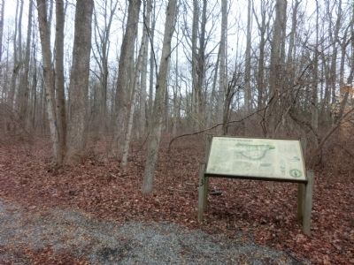
Indians of the Chesapeake
Layer of Time
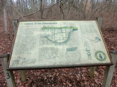
Since no books or photographs were left behind by earlier civilizations to tell us how they lived, we depend on what archaeologists find to inform us. Small pieces of the past are uncovered by digging through the layers of the earth. Each layer has its own story to tell…if you know what to look for. Our story of the Piscataway people is based on interpretations of the objects found on the land.
On the left are drawings of what an archaeologist found on this property. These small pieces are from some larger object. Can you match the small pieces with the whole object on the right? Can you tell how the object was used?
The illustration on the left show a test pit dug by an archaeologist. You can see the plow zone, or area that has been mixed up by plowing. The subsoil below is where archaeologists look for artifacts, or things made by humans.
Topics. This historical marker is listed in these topic lists: Native Americans • Settlements & Settlers.
Location. 38° 53.217′ N, 76° 32.612′ W. Marker is in Edgewater, Maryland, in Anne Arundel County. Marker is on Dock Road. The marker is located
Other nearby markers. At least 8 other markers are within 2 miles of this marker, measured as the crow flies. Java History Trail (within shouting distance of this marker); Java Plantation Life (approx. 0.3 miles away); a different marker also named Java Plantation Life (approx. 0.3 miles away); a different marker also named Java Plantation Life (approx. 0.3 miles away); a different marker also named Java Plantation Life (approx. 0.3 miles away); a different marker also named Java Plantation Life (approx. 0.3 miles away); Prized Property (approx. 0.4 miles away); The Old South River Club (approx. 1.7 miles away). Touch for a list and map of all markers in Edgewater.
Credits. This page was last revised on June 16, 2016. It was originally submitted on February 17, 2015, by Don Morfe of Baltimore, Maryland. This page has been viewed 445 times since then and 17 times this year. Photos: 1, 2, 3. submitted on February 17, 2015, by Don Morfe of Baltimore, Maryland. • Bill Pfingsten was the editor who published this page.


