Near Corinne in Box Elder County, Utah — The American Mountains (Southwest)
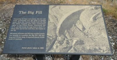
The Big Fill
Inscription.
Competing for fame and money, the two railroads constructed over 250 miles of parallel grade. Here the Central Pacific built the Big Fill before Congress gave final construction rights to the Union Pacific. Afterward, the U.P. sold the tracks through here to the C.P., which moved the road from the trestle to the fill.
250 teams of horses and 500 men worked nearly two months to complete the Big Fill. 500 feet long and 170 feet deep, it required almost 10,000 yards of material.
Erected by Bureau of Land Management.
Topics. This historical marker is listed in this topic list: Railroads & Streetcars.
Location. 41° 38.429′ N, 112° 28.783′ W. Marker is near Corinne, Utah, in Box Elder County. Marker is on West Golden Spike Drive North, on the right when traveling west. Touch for map. Marker is in this post office area: Corinne UT 84307, United States of America. Touch for directions.
Other nearby markers. At least 8 other markers are within 4 miles of this marker, measured as the crow flies. The Big Trestle (a few steps from this marker); The Track that United the States (approx. 0.3 miles away); The “Orange Special” Wreck (approx. 0.6 miles away); Big Fill Trail (approx. 0.6 miles away); Chinese Arch (approx. one mile away); The Last Cut (approx. 1˝ miles away); Irish Monument (approx. 4 miles away); Original Rail (approx. 4 miles away). Touch for a list and map of all markers in Corinne.
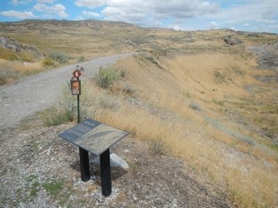
More about this marker. This marker is located in Golden Spike National Historic Site on the Big Fill Trail, Stop 6. Pick up a guidebook at the Golden Spike National Historic Site Visitors Center
Also see . . . Big Fill - Wikipedia. The Big Trestle was built in 36 days and was completed only 5 days before the golden spike ceremony at Promontory Summit. Six months after the completion ceremony, Central Pacific was awarded control of the line from Promontory to Ogden. They opted to take the rail from the poor quality Big Trestle and move it to the Big Fill, which remained in use until the rails were removed in 1942. Today both sites are part of the Golden Spike National Historic Site where a walking trail allows visitors to see the Big Fill and the remains of the Big Trestle. (Submitted on February 21, 2015, by Barry Swackhamer of Brentwood, California.)
Credits. This page was last revised on June 16, 2016. It was originally submitted on February 21, 2015, by Barry Swackhamer of Brentwood, California. This page has been viewed 719 times since then and 35 times this year. Photos: 1, 2. submitted on February 21, 2015, by Barry Swackhamer of Brentwood, California. • Andrew Ruppenstein was the editor who published this page.

