Boom Towns
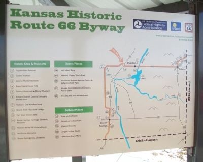
Kansas Historic Route 66 Byway
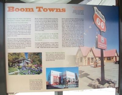
In less than 14 miles, this byway connects 3 towns, each with its own American success story.
The towns that dot Kansas Historic Route 66 were each poised for great success at the time the highway was designated in 1926. Galena was a major hub of one of the largest mineral extraction operations in the world. It's largest employer, the Eagle Picher Smelter, was one of the largest lead and zinc refineries in the nation.
Just to the east, The Empire District Electric Company's Riverton Generation Station provided electricity to 80 communities and the entire Tri-state mining industry. In addition to this business, Riverton sported a country club and the Spring River Inn on the banks of the newly created Lake Lowell.
Baxter Springs, formerly known as Kansas' First Cow Town, had already reinvented itself as the home of mining offices and their executives' families. The town maintained ordinances which strictly limited mining within the corporate limits. Consequently, the town became a refuge from the effects of the industry and the place to settle down for many of the local elites.
It is their connection to Route 66 that might just sustain Galena, Riverton and Baxter Springs into the future.
Interstate 44 bypassed the Kansas portion of Route 66 when it opened in 1961. All of U.S. Route 66 was officially
decommissioned in 1986. These facts do not matter to Scott Nelson, Owner of Nelson's Old Riverton Store. His establishment opened before the highway arrived and has remained in business long after its departure. Ironically for his business, and many others between Galena and Baxter Springs, Route 66 never went away. Today, a whole new brand of tourism dedicated to The Mother Road brings thousands of joy riders, Sunday drivers and bikers down Historic Kansas Route 66 every year. These nostalgia seekers are on the hunt for a piece of the American Main Street. Many of them aren't even American. Just take a peak at the guest book in that of an eatery like Cars on the Route. You will see names and addresses from Norway, England, France, China or Japan. The success of the Disney Pixar movie Cars has amplified this resurgence in Route 66 tourism. It is in this way that this corner of Kansas is putting its past forward.
[Photo captions read]
Nelson's Old Riverton Store
When it opened at its present location in 1923, this business catered to workers at the nearby electrical plant. Today, visitors can find a selection of food staples, deli sandwiches and soda pop similar to that sold during the hey-day of Route 66.
Cars on the Route
This Galena business retains the exterior shell and fuel pumps of the byegone [sic] Kan-O-Tex service station that
Kansas Route 66 Visitors Center
Housed in the restored Independent Oil & Gas Company station in downtown Baxter Springs
Erected 2014 by USDOT Federal Highway Administration and the State of Kansas.
Topics and series. This historical marker is listed in these topic lists: Industry & Commerce • Roads & Vehicles • Settlements & Settlers. In addition, it is included in the U.S. Route 66 series list. A significant historical year for this entry is 1926.
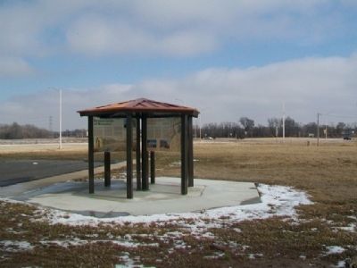
Location. 37° 4.54′ N, 94° 43.039′ W. Marker is in Riverton, Kansas, in Cherokee County. Marker is at the intersection of U.S. 400 and State Highway 66, on the right when traveling south on U.S. 400. Marker kiosk is about 300 feet west of the roundabout. Touch for map. Marker is in this post office area: Riverton KS 66770, United States of America. Touch for directions.
Other nearby markers. At least 8 other markers are within walking distance of this marker. Bridging the American Divide (here, next to this marker); Cosmopolitan Corner (here, next to this marker); Crossroads of Kansas (here, next to this marker); Land's Legacy (here, next to this marker); Baxter Springs Massacre and Today (a few steps from this marker); Fort Blair
Also see . . .
1. Kansas' Historic Route 66 Byway. (Submitted on February 27, 2015, by William Fischer, Jr. of Scranton, Pennsylvania.)
2. Kansas Route 66 Historic Byway on Facebook. (Submitted on February 27, 2015, by William Fischer, Jr. of Scranton, Pennsylvania.)
3. National Historic Route 66 Federation. (Submitted on February 27, 2015, by William Fischer, Jr. of Scranton, Pennsylvania.)
4. Historic Route 66 in Kansas. (Submitted on February 27, 2015, by William Fischer, Jr. of Scranton, Pennsylvania.)
5. Kansas Route 66 Main Page. (Submitted on February 27, 2015, by William Fischer, Jr. of Scranton, Pennsylvania.)
Credits. This page was last revised on June 20, 2023. It was originally submitted on February 27, 2015, by William Fischer, Jr. of Scranton, Pennsylvania. This page has been viewed 490 times since then and 19 times this year. Photos: 1. submitted on February 27, 2015, by William Fischer, Jr. of Scranton, Pennsylvania. 2, 3. submitted on February 26, 2015, by William Fischer, Jr. of Scranton, Pennsylvania.


