Haute-Ville in Québec in Communauté-Urbaine-de-Québec, — Central Canada (French-Canadian)
Stone Wind Mill
Moulin à vent en pierre
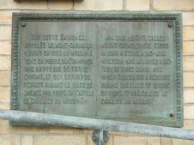
On this height, called Mont Carmel, there stood in 1690 a stone wind-mill whereon was mounted a battery of three guns, and which served for a redoubt during the siege of Quebec by Phips. It was called “Le Cavalier du Moulin.”
French:
Sur cette éminence, appelée le Mont-Carmel, il y avait en 1690 un moulin à vent en pierre, où, l’on monta une batterie de trois canons, et qui servit de redoute durant le siège de Québec par Phips. On l’appela le “Cavalier du Moulin.”
Topics. This historical marker is listed in these topic lists: Forts and Castles • War, French and Indian. A significant historical year for this entry is 1690.
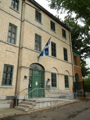
Location. 46° 48.645′ N, 71° 12.427′ W. Marker is in Québec, in Communauté-Urbaine-de-Québec. It is in Haute-Ville. Marker is on Rue Mont Carmel close to Rue des Grisons, on the left when traveling west. Touch for map. Marker is at or near this postal address: 31 Rue Mont Carmel, Québec G1R 4A4, Canada. Touch for directions.
Other nearby markers. At least 8 other markers are within walking distance of this marker. The Têtu House (within shouting distance of this marker); Sir Frederick Haldimand (about 90 meters away, measured in a direct line); Louis-Joseph de Montcalm (about 90 meters away); Joseph Bouchette (about 90 meters away); Kent House (about 90 meters away); The Jacquet House (about 120 meters away); The Maillou House (about 120 meters away); Theatre de l’Estoc (about 150 meters away). Touch for a list and map of all markers in Québec.
Also see . . . Battle of Quebec (1690) - Wikipedia. Following the capture of Port Royal in Acadia, during King William's War, the New Englanders hoped to seize Montreal and Quebec itself, the capital of New France. The loss of the Acadian fort shocked the Canadians, and Governor-General Louis de Buade de Frontenac ordered the immediate preparation of the city for siege. When the envoys delivered the terms of surrender, the Governor-General famously declared that his only reply would be by "the mouth of my cannons." (Submitted on March 10, 2015, by Barry Swackhamer of Brentwood, California.)
Credits. This page was last revised on February 9, 2023. It was originally submitted on March 9, 2015, by Barry Swackhamer of Brentwood, California. This page has been viewed 350 times since then and 15 times this year. Photos: 1, 2. submitted on March 9, 2015, by Barry Swackhamer of Brentwood, California. • Andrew Ruppenstein was the editor who published this page.

